

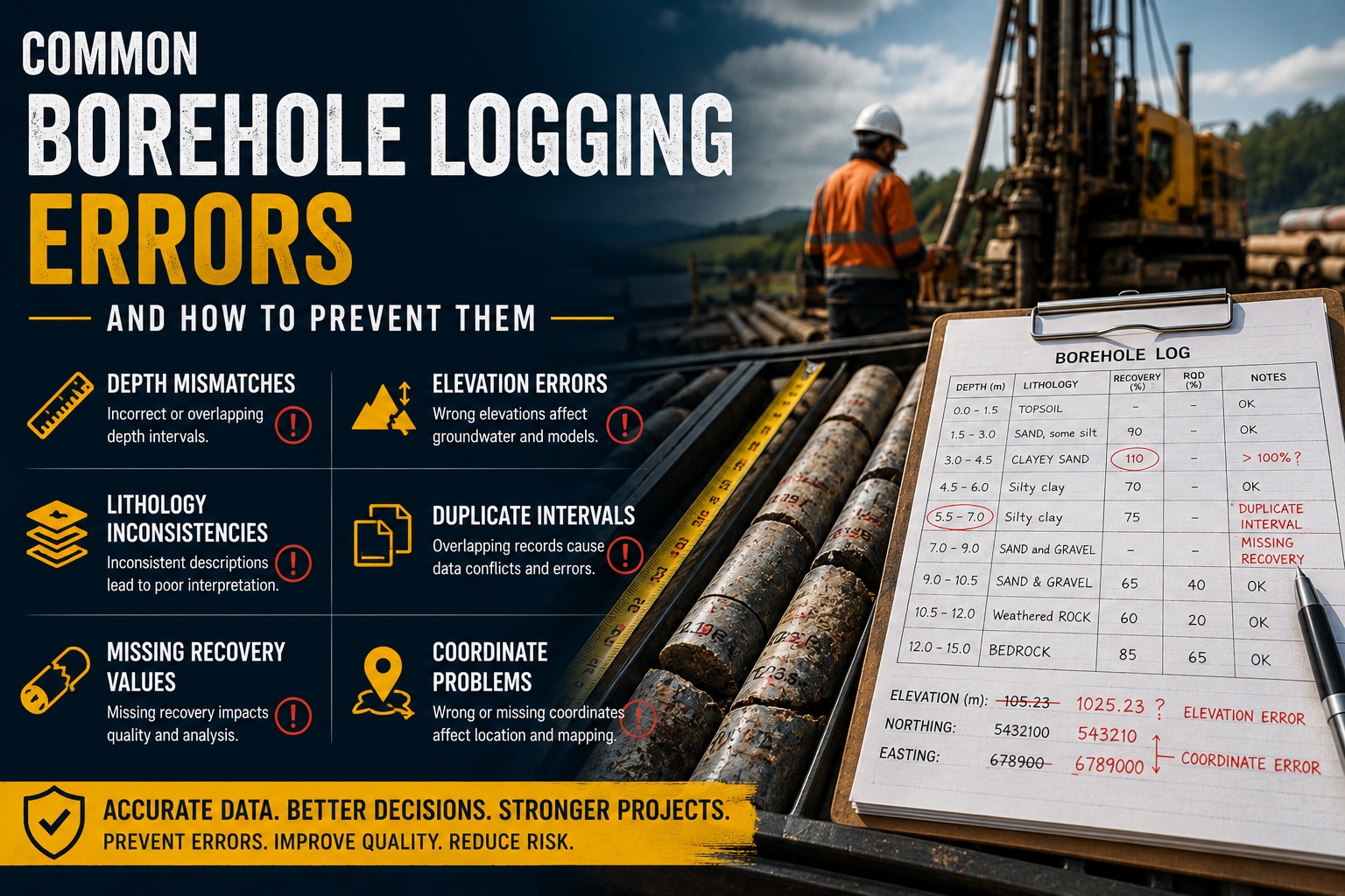
Accurate borehole logging is one of the most important components of geotechnical, environmental, mining, and hydrogeological investigations. Every engineering recommendation, geological interpretation, groundwater assessment, and regulatory submission depends on the quality of the borehole data collected in the field.
Unfortunately, borehole logging errors are extremely common. Even small mistakes can propagate through databases, reports, CAD drawings, geological models, and engineering calculations, creating expensive downstream problems.
Poor-quality borehole data can lead to:
- Rework and project delays
- Incorrect engineering decisions
- Regulatory non-compliance
- Environmental reporting issues
- Construction disputes
- Increased legal liability
Many of these issues originate from preventable field logging mistakes, inconsistent workflows, or inadequate QA/QC procedures.
This article explores some of the most common borehole logging errors and provides practical strategies to prevent them.
Why Borehole Logging Accuracy Matters
Borehole logs are far more than simple field notes. They become permanent project records used by:
- Geotechnical engineers
- Environmental consultants
- Hydrogeologists
- Mining professionals
- Regulatory agencies
- Construction contractors
- GIS and CAD teams
The data captured during drilling often supports decisions involving:
- Foundation design
- Slope stability analysis
- Groundwater modeling
- Contaminant assessment
- Resource estimation
- Excavation planning
- Infrastructure development
When logging errors occur, the consequences may not appear immediately. Problems often surface weeks, months, or even years later during design reviews, construction, or regulatory audits.
Depth Mismatches
One of the most common and damaging borehole logging errors involves incorrect depth information.
Depth mismatches occur when recorded intervals do not align properly with actual drilling progress, sample depths, laboratory records, or geological observations.
Common Causes
Depth mismatches often result from:
- Incorrect drill rod measurements
- Misread depth counters
- Switching between metric and imperial units
- Manual transcription errors
- Inconsistent interval recording
- Adjustments made after drilling without updating all records
In some cases, field crews may record depths relative to different reference points without proper documentation.
Examples of Depth Errors
Examples include:
- Sample interval overlaps
- Gaps between logged intervals
- Laboratory samples assigned to incorrect depths
- Core runs that exceed actual drilled lengths
- Groundwater readings recorded at impossible depths
Even a small depth offset can significantly affect geological interpretations and engineering calculations.
Consequences
Depth mismatches can lead to:
- Incorrect stratigraphic models
- Invalid contaminant profiles
- Foundation design errors
- Misinterpreted groundwater conditions
- Faulty geological cross-sections
In environmental investigations, incorrect sample depths may invalidate regulatory submissions or remediation plans.
Prevention Strategies
To reduce depth-related errors:
Use Standardized Depth Referencing
Clearly define whether depths are measured from:
- Ground surface
- Drill rig reference point
- Top of casing
- Kelly bar reference
Ensure all personnel use the same reference.
Implement Real-Time Validation
Digital logging systems can automatically detect:
- Overlapping intervals
- Missing depth ranges
- Impossible measurements
- Interval continuity errors
Cross-Check Field and Laboratory Records
Verify that laboratory sample depths match field logs before finalizing reports.
Train Personnel Consistently
Field staff should follow standardized interval recording procedures across all projects.
Elevation Errors
Elevation data is critical for groundwater interpretation, engineering design, and spatial modeling. Unfortunately, elevation errors are surprisingly common in borehole databases.
Common Causes
Elevation problems may result from:
- Incorrect survey data
- GPS inaccuracies
- Coordinate system confusion
- Datum mismatches
- Typographical errors
- Improper unit conversions
In some projects, elevations are estimated instead of surveyed, creating significant uncertainty.
Why Elevation Accuracy Matters
Incorrect elevations can distort:
- Groundwater flow directions
- Hydraulic gradients
- Geological surfaces
- Cross-sections
- Contaminant migration models
For geotechnical projects, inaccurate elevations may affect slope stability analysis, excavation design, and infrastructure placement.
Examples of Elevation Problems
Typical issues include:
- Boreholes appearing above or below ground surface
- Groundwater elevations higher than casing elevations
- Negative elevations in non-negative regions
- Inconsistent site datum usage
- Vertical exaggeration in geological models
These errors may not become obvious until spatial analysis or 3D modeling is performed.
Prevention Strategies
Standardize Coordinate Systems and Datums
Clearly define:
- Horizontal coordinate system
- Vertical datum
- Units of measurement
Ensure all project participants use consistent standards.
Validate Elevation Relationships
QA/QC systems should automatically check:
- Groundwater elevations relative to borehole elevations
- Casing stick-up values
- Reasonable regional elevation ranges
Use Professional Survey Control
Critical projects should use surveyed borehole collar elevations instead of handheld GPS estimates.
Maintain Metadata
Document:
- Survey methods
- Datum references
- Equipment accuracy
- Coordinate transformations
This improves traceability and reduces future confusion.
Lithology Inconsistencies
Lithology logging is inherently interpretive, which makes consistency a major challenge.
Different geologists or field technicians may describe the same material differently, creating inconsistent datasets that complicate analysis and reporting.
Common Lithology Problems
Typical inconsistencies include:
- Different naming conventions
- Variable grain size descriptions
- Inconsistent color terminology
- Mixed classification systems
- Non-standard abbreviations
- Missing weathering descriptions
For example, one logger may record:
- “Brown sandy clay”
while another records:
- “Clayey sand with silt”
for similar material.
Consequences
Lithology inconsistencies affect:
- Geological modeling
- Stratigraphic interpretation
- Material quantity estimates
- Resource modeling
- Environmental assessments
- Engineering correlations
Inconsistent coding also creates problems when importing data into GIS, CAD, or database systems.
Prevention Strategies
Use Standardized Classification Systems
Adopt recognized standards such as:
- USCS
- ASTM
- ISO
- Local geological standards
Implement Controlled Vocabularies
Digital logging systems should provide predefined lookup lists rather than free-text entry whenever possible.
Create Logging Guidelines
Provide field staff with:
- Standard terminology
- Example descriptions
- Classification charts
- Project-specific coding rules
Conduct Peer Reviews
Senior geologists or QA reviewers should periodically review logs for consistency.
Use Digital Templates
Structured forms reduce variation and improve completeness.
Duplicate Intervals
Duplicate intervals occur when overlapping or repeated depth ranges are entered into the borehole log.
These errors commonly appear during manual data entry, editing, or database imports.
Examples
Duplicate interval problems include:
- Two lithology records covering the same depth range
- Overlapping sample intervals
- Repeated recovery entries
- Duplicate laboratory associations
For example:
- 10.0–12.0 m
- 11.5–13.0 m
may accidentally overlap without explanation.
Why Duplicate Intervals Are Dangerous
Duplicate intervals can:
- Corrupt geological models
- Distort contaminant calculations
- Break automated reporting tools
- Create conflicting engineering interpretations
In some software systems, overlapping intervals may also cause import failures or reporting errors.
Prevention Strategies
Use Automated Validation Rules
Modern QA/QC systems should automatically detect:
- Overlapping intervals
- Missing intervals
- Invalid depth sequences
Prevent Manual Free-Form Editing
Structured interval entry reduces accidental overlaps.
Implement Database Constraints
Database rules can prevent duplicate depth ranges from being saved.
Review Data Before Import
Imported laboratory or contractor data should be validated before integration.
Missing Recovery Values
Core recovery and sample recovery data are essential for evaluating subsurface conditions, particularly in geotechnical and mining projects.
Unfortunately, recovery values are often incomplete or missing entirely.
Common Causes
Missing recovery information may result from:
- Incomplete field notes
- Rushed logging
- Lost drill run records
- Poor communication between drillers and loggers
- Inconsistent workflow procedures
Consequences
Missing recovery values can affect:
- Rock quality interpretation
- RQD calculations
- Fracture analysis
- Engineering design
- Resource evaluation
Without recovery data, engineers may underestimate drilling difficulties or rock mass problems.
Prevention Strategies
Use Mandatory Fields
Digital systems should require recovery entries before logs can be finalized.
Standardize Recovery Procedures
Ensure drillers and geologists use consistent methods for measuring:
- Core recovery
- SCR
- TCR
- RQD
Integrate Driller and Logger Workflows
Improved communication between field personnel reduces missing information.
Perform Daily QA Reviews
Field supervisors should verify completeness before crews leave the site.
Coordinate Problems
Coordinate issues are among the most severe borehole data errors because they affect every spatial interpretation.
Incorrect coordinates can place boreholes in completely wrong locations.
Common Coordinate Errors
Examples include:
- Swapped latitude and longitude
- Incorrect UTM zones
- Wrong coordinate systems
- Datum conversion mistakes
- Missing coordinate metadata
- Typographical errors
Sometimes boreholes may appear hundreds of kilometers from the project site due to simple entry mistakes.
Consequences
Coordinate errors affect:
- GIS mapping
- Geological models
- Groundwater interpretation
- Environmental assessments
- Infrastructure alignment
- Regulatory reporting
Incorrect locations can invalidate entire datasets.
Prevention Strategies
Use Coordinate Validation
QA/QC systems should verify:
- Coordinates fall within project boundaries
- Elevations match regional expectations
- Coordinate formats are correct
Standardize Spatial Reference Systems
Clearly define approved systems such as:
- UTM NAD83
- State Plane
- Local grid systems
Avoid Manual Coordinate Entry
Whenever possible, import coordinates directly from survey equipment or GIS systems.
Store Full Spatial Metadata
Include:
- Datum
- Projection
- Units
- Survey methods
- Accuracy estimates
The Importance of Borehole QA/QC
Many borehole logging errors are preventable through strong QA/QC procedures.
An effective QA/QC program should include:
- Standardized workflows
- Automated validation rules
- Structured digital logging
- Audit trails
- Data review processes
- Staff training
- Centralized databases
Modern borehole management systems can automatically detect many common problems before they affect reports or engineering decisions.
Final Thoughts
Borehole logging errors may seem minor during field operations, but their long-term consequences can be extremely costly. Depth mismatches, elevation errors, lithology inconsistencies, duplicate intervals, missing recovery values, and coordinate problems all have the potential to compromise engineering reliability, environmental compliance, and project success.
As projects become increasingly data-driven, organizations must prioritize borehole QA/QC and standardized data management practices.
High-quality borehole data reduces risk, improves decision-making, strengthens regulatory compliance, and helps ensure successful project outcomes.
Preventing logging errors at the source is always less expensive than correcting them later.