

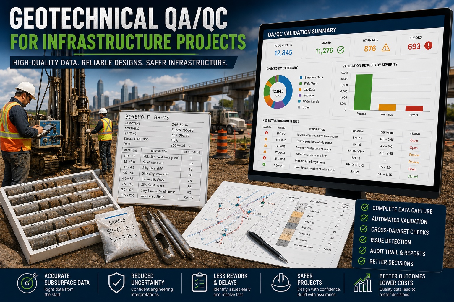
Every successful infrastructure project begins below the surface. Before a highway is widened, a bridge is constructed, a railway is extended, or a water treatment plant is built, engineers must understand the subsurface conditions that will support the structure for decades to come.
This understanding comes from geotechnical investigations. Boreholes, Standard Penetration Tests (SPT), cone penetration testing (CPT), laboratory testing, groundwater monitoring, and geological logging collectively provide the data used to design foundations, retaining structures, embankments, tunnels, and other critical infrastructure.
The accuracy of these designs depends directly on the quality of the underlying data. Errors in borehole locations, soil descriptions, groundwater measurements, laboratory results, or engineering calculations can lead to costly redesigns, construction delays, safety concerns, and regulatory issues.
For this reason, Quality Assurance and Quality Control (QA/QC) have become essential components of modern infrastructure investigations. Increasingly, organizations are moving beyond manual reviews and adopting automated validation systems that continuously check geotechnical data for completeness, consistency, and engineering accuracy.
This article explores the importance of geotechnical QA/QC, the most common data quality issues encountered on infrastructure projects, and how automated validation improves confidence in engineering decisions.
Why Geotechnical QA/QC Matters
Infrastructure projects rely on accurate subsurface information to answer fundamental engineering questions:
- Can the soil support the proposed loads?
- Is bedrock present at a practical depth?
- Will settlement be acceptable?
- Is liquefaction a concern?
- What groundwater conditions exist?
- Are excavations stable?
- Will slope failures occur?
- Is ground improvement required?
These questions cannot be answered reliably if the underlying data are incomplete or inaccurate.
Unlike structural calculations that can often be recalculated later, missing field data frequently cannot be recovered once drilling equipment has left the site.
Preventing errors at the time of collection is therefore far more effective than correcting them during design.
Components of a Geotechnical Investigation
Infrastructure investigations typically include multiple data sources that must work together.
These include:
Borehole Information
- Borehole locations
- Elevations
- Coordinates
- Survey information
- Drilling methods
- Casing details
Geological Logging
- Soil classification
- Rock descriptions
- Weathering
- Stratigraphy
- Fill materials
- Organics
Field Testing
Examples include:
- Standard Penetration Test (SPT)
- Cone Penetration Test (CPT)
- Vane shear testing
- Pressuremeter testing
- Permeability testing
- Plate load testing
Laboratory Testing
Typical laboratory analyses include:
- Moisture content
- Atterberg Limits
- Grain size distribution
- Density
- Triaxial testing
- Consolidation
- Shear strength
- Organic content
Groundwater Monitoring
Groundwater observations may include:
- Water levels
- Seasonal fluctuations
- Artesian conditions
- Pumping tests
- Hydraulic conductivity
Every dataset contributes to engineering design and therefore requires QA/QC.
Common Data Quality Problems
Large infrastructure projects often contain hundreds of boreholes and tens of thousands of records.
Typical data quality problems include:
- Missing borehole coordinates
- Incorrect elevations
- Overlapping intervals
- Gaps between logged intervals
- Missing groundwater measurements
- Incorrect SPT calculations
- Missing laboratory results
- Duplicate samples
- Incorrect lithology coding
- Unit conversion errors
- Copy-and-paste mistakes
Even seemingly minor issues can affect engineering interpretations.
Borehole Location Validation
The first QA/QC step is verifying that boreholes are correctly located.
Validation can identify:
- Missing coordinates
- Duplicate boreholes
- Invalid coordinate systems
- Incorrect elevations
- Boreholes outside project limits
Incorrect locations may cause foundation conditions to be interpreted incorrectly.
Interval Integrity
Every borehole should contain continuous logging.
Validation detects:
Overlapping Intervals
Example:
4.0–5.5 m
5.2–6.0 m
These intervals overlap.
Missing Depths
Example:
4.0–5.0 m
6.0–7.0 m
The missing metre should be investigated.
Incorrect Interval Order
Depth intervals should always increase continuously.
Soil Classification Consistency
Infrastructure designs often rely on standardized classification systems such as:
- Unified Soil Classification System (USCS)
- AASHTO
- Local transportation agency standards
Validation ensures:
- Valid soil symbols
- Required descriptions
- Consistent terminology
- Correct coding
Standardized classifications improve communication between engineers, contractors, and regulatory agencies.
Validating SPT Data
The Standard Penetration Test is one of the most commonly used field investigations.
Automated validation checks include:
- Missing blow counts
- Incorrect N-value calculations
- Impossible values
- Duplicate tests
- Required testing intervals
- Refusal conditions
- Geological consistency
These rules improve confidence in foundation analyses and liquefaction assessments.
Laboratory Data Validation
Laboratory testing introduces another potential source of error.
Validation can identify:
- Missing moisture content
- Invalid Atterberg Limits
- Impossible grain size percentages
- Incorrect density values
- Duplicate samples
- Laboratory result mismatches
Cross-checking laboratory and field observations provides an additional layer of quality control.
Groundwater QA/QC
Groundwater influences:
- Excavation stability
- Dewatering
- Foundation performance
- Frost susceptibility
- Slope stability
Validation helps identify:
- Missing water levels
- Unrealistic fluctuations
- Incorrect measurement dates
- Duplicate readings
- Inconsistent monitoring records
Projects that span multiple seasons particularly benefit from continuous groundwater validation.
Cross-Dataset Validation
Modern QA/QC systems evaluate relationships between datasets rather than checking each independently.
Examples include:
- Soft clay should generally have lower SPT N-values than dense sand.
- Organic soils should have appropriate moisture content and density.
- Rock intervals should contain Recovery, SCR, TCR, and RQD values where applicable.
- Laboratory samples should correspond to valid borehole intervals.
- Groundwater observations should fall within the borehole depth.
These relationships often reveal errors that simple range checking cannot detect.
Detecting Unusual Engineering Values
Automated validation distinguishes between impossible values and unusual values.
For example:
- Very high SPT N-values in peat
- Extremely low density in competent rock
- Recovery greater than 100%
- RQD greater than SCR
Some values are impossible and should be corrected immediately.
Others are simply unusual and require engineering review.
This distinction helps prioritize QA/QC efforts.
Supporting Transportation Projects
Transportation infrastructure projects often involve:
- Highways
- Bridges
- Railways
- Airports
- Transit systems
These projects may include hundreds of investigation locations collected over several years by multiple consultants.
Automated QA/QC ensures that all data are evaluated using the same engineering standards before being incorporated into design models or digital asset management systems.
Supporting Digital Engineering
Many infrastructure owners are adopting digital engineering workflows that integrate geotechnical information with:
- Building Information Modeling (BIM)
- Geographic Information Systems (GIS)
- Digital twins
- Asset management systems
- Construction management platforms
High-quality geotechnical data are essential for these systems to function effectively.
Automated validation improves confidence before information is shared across multiple disciplines.
Batch Validation Across Entire Projects
One of the greatest advantages of automated QA/QC is the ability to validate entire projects rather than individual boreholes.
Project-wide validation can review:
- Thousands of boreholes
- Tens of thousands of intervals
- Laboratory databases
- Groundwater records
- SPT results
- Geological descriptions
- Engineering observations
Validation reports summarize issues by severity, location, and category, allowing project teams to focus on resolving the most significant problems first.
Supporting Regulatory Compliance
Infrastructure projects frequently require compliance with agency specifications and contractual quality requirements.
Automated validation provides:
- Consistent rule enforcement
- Repeatable QA/QC procedures
- Documented validation reports
- Audit trails
- Project quality metrics
- Transparent review processes
This documentation supports technical reviews, regulatory submissions, and client acceptance.
Data Migration and Long-Term Asset Management
Many infrastructure organizations maintain geotechnical records for decades.
Historical information is often migrated from:
- Paper logs
- Spreadsheets
- Legacy databases
- Older borehole software
Automated validation identifies:
- Missing fields
- Duplicate boreholes
- Incorrect coordinates
- Invalid classifications
- Mapping errors
- Unit inconsistencies
Ensuring historical data quality protects the value of long-term geotechnical archives and enables future reuse for rehabilitation, expansion, and maintenance projects.
WinLoG Automated Geotechnical QA/QC
WinLoG includes an advanced validation engine designed specifically for geotechnical, geological, hydrogeological, and environmental investigations. Rather than validating only individual fields, WinLoG evaluates engineering relationships across the entire project database.
The validation engine automatically checks borehole locations, interval continuity, soil classifications, SPT calculations, Recovery, RQD, SCR, TCR, groundwater observations, laboratory results, and many other engineering parameters. Cross-dataset validation compares field observations, laboratory data, and geological logging to identify inconsistencies that may affect engineering interpretations.
Validation can be performed during data entry, after importing AGS, DIGGS, CSV, or legacy databases, or across an entire infrastructure project before design or reporting. Detailed validation reports classify findings by severity, provide explanations for each issue, and maintain a complete audit trail of corrections and approvals.
Organizations can also create custom rule libraries to enforce company standards, transportation agency specifications, or client-specific QA/QC requirements, ensuring that every project is reviewed consistently.
Best Practices for Infrastructure QA/QC
Organizations can improve geotechnical data quality by adopting several proven practices:
- Validate data continuously during field investigations.
- Standardize soil classification terminology.
- Use controlled vocabularies and coding systems.
- Verify borehole coordinates before drilling begins.
- Automate validation of SPT calculations and laboratory results.
- Perform project-wide QA/QC before engineering design.
- Maintain complete audit trails of edits and approvals.
- Review unusual engineering values rather than relying solely on range checks.
- Validate imported historical data before reuse.
- Establish company-specific validation rules for recurring project types.
These practices improve consistency, reduce rework, and strengthen confidence in engineering decisions.
Conclusion
Infrastructure projects depend on accurate geotechnical information. From the first borehole to the final design report, every soil description, groundwater measurement, laboratory result, and field test contributes to engineering decisions that affect public safety, construction costs, and long-term asset performance.
Manual reviews remain important, but they are no longer sufficient for today’s large, data-intensive infrastructure projects. Automated QA/QC provides a faster, more consistent, and more comprehensive approach by continuously checking borehole records, field tests, laboratory data, and engineering relationships for errors and inconsistencies.
By integrating automated validation into everyday workflows, engineering organizations can improve data quality, streamline project reviews, support regulatory compliance, and deliver more reliable designs. As digital engineering and infrastructure asset management continue to evolve, robust geotechnical QA/QC is becoming a critical foundation for successful projects and better-informed engineering decisions.