

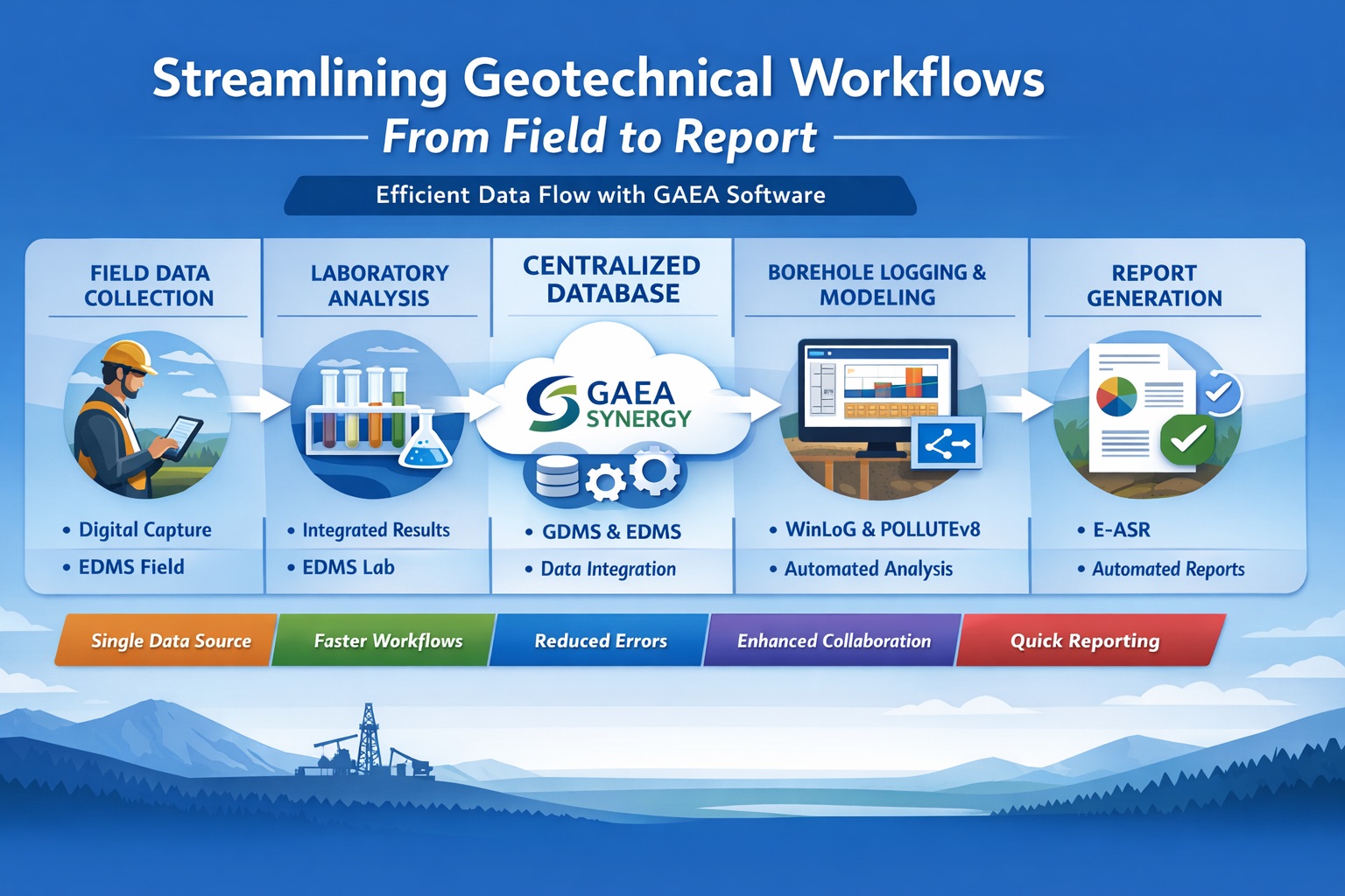
Infrastructure projects depend on a coherent understanding of the ground. Borehole observations, recovered samples, laboratory measurements, groundwater records, and interpreted profiles all contribute evidence, but they are often prepared by different people at different times. When those records become disconnected, engineers spend extra effort establishing which result belongs to which location and whether a drawing reflects the latest information.
A connected geotechnical workflow preserves the path from source observation to reviewed deliverable. WinLoG, GDMS, and WinFence address complementary parts of that process: logging, laboratory data, and subsurface interpretation. Used with a defined information structure and appropriate review, they can support consistent project outputs while keeping the evidence behind those outputs accessible.
Understand the product roles before designing the workflow
WinLoG provides structured borehole and well records, configurable templates, and released validation capabilities. GDMS manages supported laboratory test workflows, including measurements, calculations, engineering curves, and reports. WinFence creates editable geological cross-sections and fence diagrams from borehole information.
WinFence shares project and borehole data with WinLoG within GaeaSynergy. Wider laboratory and project integration depends on the applicable products and licensing. Confirm the selected configuration and supported exchange paths before implementation. A complete information workflow still requires engineering interpretation and design work appropriate to the project; these products should not be described as automatically producing a finished infrastructure design.
1. Start with the investigation questions
Define what the ground investigation needs to inform. A transportation corridor, bridge foundation, retaining structure, and buried utility may require different records and deliverables. Translate those needs into a practical information plan: the locations and observations to record, samples to identify, tests to commission, and profiles or summaries to prepare.
Agree the deliverable requirements with the project team before configuring templates. Identify which terminology, units, symbols, and report layouts need to be consistent across the investigation. Separate mandatory requirements from preferences that can be refined during a pilot. This keeps configuration focused on the information needed for review and subsequent engineering work.
Establish a common location register and identifier convention. Borehole names, sample numbers, specimen references, and investigation phases should remain distinguishable. Record coordinate systems and elevation references explicitly, especially where historical investigations use local grids or assumed datums. An apparently precise coordinate is not a substitute for a known reference.
2. Build consistent borehole records in WinLoG
WinLoG templates can present descriptions, sampled intervals, measurements, groundwater observations, and construction information in a depth-based log. Structured records help keep the underlying information reusable rather than leaving the issued drawing as the only accessible account of the investigation. Configure the output around the records needed for the project.
During preparation, distinguish original observations from later interpretation. Preserve field remarks that explain unusual conditions, incomplete recovery, or changes in drilling method. Where a description is standardized for consistency, retain enough source context for a reviewer to understand the change. A uniform-looking log should not conceal uncertainty that was present in the field record.
Check interval references carefully. A sample interval, a described stratum, and a drilling run may cover different depth ranges. They should remain related without being forced into an artificial one-to-one correspondence. Review the recorded hole depth, interval order, units, and any gaps against the supporting field information.
3. Validate records before using them downstream
WinLoG Validation and QA/QC supports checks of values and related datasets, with findings that identify records requiring attention. Use those findings as part of a documented review, alongside source comparisons and the judgment of staff familiar with the investigation.
Assign each material issue a resolution. A missing value may require recovery from the field notes; an unusual value may be correct but need explanation. Do not change data simply to remove a warning. Record what was checked, what changed, and what remains uncertain so downstream users can distinguish reviewed information from unresolved records.
Define when a log is ready for interpretation. A preliminary log may be useful during planning, but it should not be confused with an approved record. Agree a practical status and version convention for the project, including how corrections will be communicated to the people preparing test summaries and sections.
4. Keep laboratory results connected to samples in GDMS
GDMS organizes test information by project, sample, material, specimen, and test type. Its supported workflows cover soil and aggregate, concrete, asphalt, and rock testing, with calculations and outputs appropriate to the selected test. Confirm that the required methods, inputs, and report forms are supported for the work being evaluated.
The laboratory record should preserve the measurements behind the reported result. Sample and specimen identity, preparation details, units, and relevant observations make it possible to investigate an unexpected value without starting from a disconnected final report. GDMS provides the test-processing context; the laboratory remains responsible for applicable methods, quality procedures, and authorized results.
At the project handoff, reconcile requested tests with received results. Investigate unmatched sample references before using the values in summaries or interpretations. A sample taken from one interval must not become associated with a similar-looking identifier from another borehole or investigation phase. Keep the original report and any amendments traceable to the project record.
5. Review test results in geological context
A laboratory value describes the tested specimen under the conditions of the test. Deciding how it represents a broader geological unit is a separate engineering task. Review the sample location, interval, recovery context, and available descriptions before grouping results or using them to support a material interpretation.
Look for disagreements that deserve investigation. A test classification may differ from a field description because the materials vary, because the specimen represents only part of an interval, or because a record needs correction. Treat the disagreement as a question to resolve rather than automatically preferring whichever result is easier to place in a table.
Keep observations, measured results, and selected design values distinguishable. If a project summary introduces an adopted parameter or grouping, document its basis through the engineering review process. The ability to retrieve a laboratory report is valuable, but it does not by itself explain the judgment used to select a value for design.
6. Develop and refine sections in WinFence
WinFence can generate an initial correlation using borehole lithology, layer thickness, and stratigraphic occurrence. The interpretation remains editable, allowing the geoscientist to refine boundaries and review relationships between intersecting sections. Completed sections can also be presented as three-dimensional fence diagrams.
Select the section alignment to answer a defined project question. Review the borehole positions, ground elevations, and the information shown before accepting the initial display. Where records are projected onto an alignment, make their relationship to that alignment clear in the presentation and review procedure.
Treat the space between boreholes as interpreted ground. Similar descriptions at two locations do not prove that a layer is continuous between them, and an automated correlation is a starting point for review. Explain the evidence for important boundaries and retain uncertainty where investigation coverage is limited. Avoid giving a polished drawing more authority than the observations support.
A hypothetical road-corridor investigation
Consider a team investigating a proposed road corridor with several shallow boreholes and a deeper investigation near a structure. The team prepares consistent logs, preserves location and elevation references, and identifies samples selected for laboratory work. One borehole contains a thin weak layer that is not observed in the adjacent holes.
Laboratory results arrive for selected specimens, including one result with an inconsistent sample reference. The team checks the field and laboratory records before accepting that association. It then reviews the results alongside the descriptions, recording where the samples support a material grouping and where the available evidence remains limited.
The team creates a preliminary section and examines the weak layer rather than automatically extending it across the corridor. It records the interpretation and the uncertainty associated with its extent. If further investigation changes the understanding, the affected log, section, and engineering summary are reviewed together. The benefit is a traceable revision process, not a claim that software has resolved unknown ground conditions.
7. Control revisions across the deliverable package
Infrastructure investigations often continue while design develops. New survey information, amended test results, and additional boreholes can change earlier outputs. Assign responsibility for deciding which deliverables a correction affects. Updating a source record is only the first step if an issued table, section, or report still contains the previous information.
Maintain an identifiable issue package with the approved logs, test reports, sections, and supporting notes. Record the versions and dates used for each issue. Keep working interpretations separate from delivered outputs so future users can understand what was known at the time and what changed later.
Use a pilot to test the complete handoff
Before adopting the workflow across several projects, run a bounded pilot with representative logs, laboratory cases, and at least one section. Include an exception and a correction so the test covers more than the simplest path. Define the expected results before the pilot starts and assign reviewers for each stage.
- Data identity: Can a reviewer trace a test result to the correct specimen, sample, interval, and borehole?
- Output quality: Do logs and laboratory reports contain the agreed fields, units, and explanatory notes?
- Interpretation: Are important section boundaries supported by identifiable evidence and professional review?
- Change control: Can the team identify and update outputs affected by a corrected source record?
- Usability: Can intended users complete routine tasks with the agreed instructions and configuration?
Measure preparation, review, and rework as well as production time. Record any remaining configuration, licensing, migration, or training requirements. Use the findings to establish a repeatable process for the next project instead of assuming that a successful example covers every historical dataset or investigation type.
To discuss your requirements, request a guided GAEA demonstration or pilot discussion. Bring representative logs, test reports, and section requirements. A complete geotechnical workflow connects those records through consistent identity, reviewed data, and explicit interpretation, giving the infrastructure team a clearer basis for its engineering decisions.