

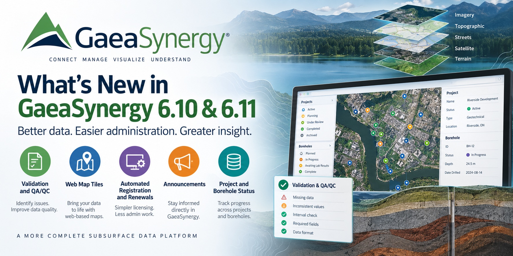
GaeaSynergy 6.10 and 6.11 introduce a significant collection of improvements focused on three increasingly important areas of subsurface data management: data quality, easier software administration, and better visibility into project information.
The releases add Validation and QA/QC capabilities, web map tiles, automated software registration and maintenance renewals, in-product announcements, and project and borehole status tracking.
Together, these enhancements make GaeaSynergy easier to administer while helping organizations manage increasingly large and complex collections of geotechnical, geological, and environmental data.
Validation and QA/QC
One of the most important additions is expanded support for Validation and Quality Assurance/Quality Control (QA/QC).
Subsurface databases can contain information collected over many years, by different personnel, consultants, laboratories, and field programs. Even when organizations use standardized procedures, inconsistencies can occur.
Examples can include missing information, inconsistent measurements, questionable values, incomplete intervals, or data that does not conform to an organization’s expected standards.
GaeaSynergy’s integration with WinLoG Validation and QA/QC provides a more systematic way to identify these issues.
Instead of relying exclusively on manual review, automated validation can help identify potential data-quality problems so they can be reviewed before information is used for interpretation, reporting, cross-sections, modelling, or other downstream applications.
This is particularly valuable for organizations managing large borehole databases where manually reviewing every record is impractical.
Moving from data storage toward governed data
Validation is also an important step in GAEA’s longer-term strategy for subsurface data management.
A database should do more than simply store information. Organizations increasingly need to know whether the information is complete, internally consistent, and suitable for its intended use.
Combining centralized data management in GaeaSynergy with automated Validation and QA/QC in WinLoG helps create a foundation for more governed subsurface data.
This becomes increasingly important as organizations reuse historical data for new projects, regional studies, GIS analysis, modelling, and emerging AI-assisted workflows.
Web Map Tiles
GaeaSynergy 6.10 and 6.11 also expand mapping capabilities with support for web map tiles.
Web-based mapping layers can provide geographic context without requiring organizations to maintain all of the underlying basemap information themselves.
Users can view project locations, boreholes, wells, monitoring points, samples, and other spatial information against appropriate map backgrounds.
This makes it easier to understand the relationship between subsurface information and its surrounding geographic environment.
For organizations managing projects across multiple regions, web mapping can also make navigating large collections of projects and stations more intuitive.
Rather than treating mapping as a separate activity, geographic information becomes a more integrated part of the data-management workflow.
Automated Software Registration
Software deployment and licensing are important considerations for organizations using GaeaSynergy across multiple computers or users.
The new releases introduce automated registration capabilities designed to simplify this process.
Automating more of the registration workflow reduces the amount of manual communication required when activating software and helps users get systems operational more quickly.
This is particularly useful when software is being deployed across multiple workstations or when IT departments are responsible for maintaining installations.
The result is a smoother licensing experience for both individual users and larger organizations.
Automated Maintenance Renewals
GaeaSynergy 6.10 and 6.11 also improve the way annual software maintenance is managed.
Automated renewal capabilities help users determine when maintenance is approaching expiration and provide a more direct path for renewing it.
Active annual maintenance provides access to software updates and upgrades as well as GAEA technical support.
Integrating maintenance information more closely with the software reduces the possibility of users unknowingly operating with expired maintenance and makes it easier for organizations to keep their installations current.
For IT administrators, this can also simplify the task of managing software lifecycle requirements.
Announcements Inside GaeaSynergy
Another new capability is the GaeaSynergy announcement system.
Important product information can now be communicated directly through the software.
Announcements may include information such as:
- New software releases and features
- Important updates
- New tutorials and documentation
- Maintenance information
- Product and service announcements
This creates a more direct communication channel between GAEA and GaeaSynergy users.
Previously, users might not discover an important new capability unless they visited the GAEA website, received an email, or contacted technical support. In-product announcements make relevant information available where users are already working.
Announcements are designed to provide useful information without interfering with normal project work.
Project Status
Large subsurface databases frequently contain projects at very different stages of their lifecycle.
A project might be proposed, active, under review, completed, archived, or have another organization-defined status.
GaeaSynergy now provides improved support for tracking project status, giving users another way to organize and understand their project portfolio.
Status information can make it easier to distinguish current work from historical information and can help teams understand where a project sits within their workflow.
For organizations with hundreds or thousands of projects, this additional context can become particularly valuable.
Borehole Status
Status tracking is also available at the borehole level.
A project containing many boreholes may have individual locations at different stages of completion. One borehole might be planned while another is being drilled, another is awaiting laboratory results, and another is complete.
Recording borehole status gives project teams better visibility into this process.
It can also help identify records that are still being developed and distinguish them from information that has reached a later stage of the workflow.
When combined with Validation and QA/QC, borehole status can form part of a more structured data-management process in which information progresses from collection through review and eventual completion.
Building a More Complete Subsurface Data Platform
Although each of these features addresses a different requirement, together they represent a broader direction for GaeaSynergy.
Traditional subsurface databases have primarily concentrated on storing and retrieving data.
Modern engineering and environmental organizations increasingly need more.
They need to understand where their information came from, whether it has been checked, what stage a project has reached, how data relates geographically, and whether the software environment itself is current and properly maintained.
GaeaSynergy 6.10 and 6.11 continue moving the platform in this direction.
Validation and QA/QC improve confidence in the data.
Project and borehole status provide workflow context.
Web map tiles improve geographic context.
Automated registration and renewals simplify administration.
Announcements provide a direct way to keep users informed about the software they use.
Together, these capabilities help transform a collection of subsurface records into a more organized and manageable information resource.
Part of GAEA’s Continuing Development
GaeaSynergy 6.10 and 6.11 are also part of GAEA’s broader development roadmap for its subsurface software platform.
Future development is focused on making it easier to migrate legacy information, improve data governance, visualize subsurface information, and make large engineering and environmental datasets more useful throughout their lifecycle.
For organizations with historical borehole, geological, geotechnical, or environmental information, these developments are particularly important. The value of historical data increases when it can be migrated, validated, organized, mapped, and reused rather than remaining isolated in legacy applications or project files.
GaeaSynergy provides the centralized environment for managing that information, while applications such as WinLoG provide specialized tools for borehole logging, reporting, Validation and QA/QC.
Upgrade to GaeaSynergy 6.10 and 6.11
Customers with current annual maintenance are encouraged to keep their GaeaSynergy installations up to date so they can take advantage of the latest functionality and improvements.
Organizations evaluating GaeaSynergy can also contact GAEA to discuss how the platform can be used for centralized management of geotechnical, geological, environmental, and other subsurface information.
Learn more about GaeaSynergy, WinLoG Validation and QA/QC, and GAEA’s ongoing development roadmap on the GAEA Technologies website.