
Environmental site assessments are a cornerstone of environmental due diligence and contaminated site management. While Phase I Environmental Site Assessments (ESAs) focus on identifying potential environmental concerns through records review and site reconnaissance, Phase II Environmental Site Assessments involve direct investigation of soil, groundwater, and sometimes soil gas to confirm whether contamination is present.
Phase II investigations often generate large volumes of environmental data. Soil and groundwater sampling programs can involve dozens or hundreds of monitoring points, laboratory analytical results, field measurements, and geological observations. Traditionally, organizing and interpreting this information required extensive manual effort. Environmental consultants frequently spent weeks compiling data tables, drafting figures, preparing cross-sections, and writing technical reports.
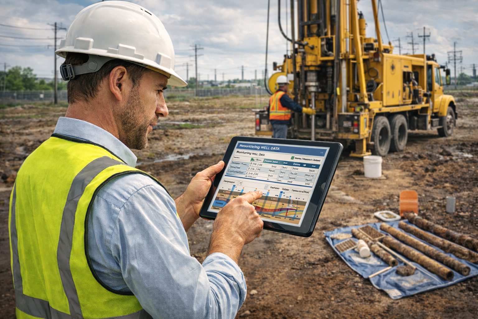
Today, automation is transforming Phase II environmental reporting workflows. Digital tools, integrated databases, geospatial analysis platforms, and automated reporting systems allow environmental professionals to streamline the reporting process while maintaining scientific rigor and regulatory compliance.
This article explores how automation is reshaping Phase II Environmental Site Assessment reporting, the technologies enabling these changes, and best practices for implementing automated environmental investigation workflows.
Understanding Phase II Environmental Site Assessments
A Phase II Environmental Site Assessment is conducted when potential contamination risks have been identified during a Phase I ESA or when regulatory agencies require further investigation.
The goal of a Phase II ESA is to determine:
- Whether contamination is present
- The types of contaminants involved
- The extent of contamination
- Potential risks to human health or the environment
Phase II investigations typically involve a combination of field sampling, laboratory analysis, and environmental data interpretation.
Common Components of Phase II Investigations
Phase II environmental assessments may include:
Soil Sampling
Soil samples are collected from boreholes or test pits to evaluate contamination in subsurface soils.
Common contaminants analyzed include:
- Petroleum hydrocarbons
- Volatile organic compounds (VOCs)
- Semi-volatile organic compounds (SVOCs)
- Heavy metals
- Polycyclic aromatic hydrocarbons (PAHs)
Groundwater Monitoring
Monitoring wells are installed to collect groundwater samples and measure groundwater elevations. These data help determine:
- Groundwater flow direction
- Contaminant concentrations
- Contaminant plume migration
Soil Gas Investigations
Soil gas sampling may be conducted when volatile contaminants are suspected. Soil gas surveys help evaluate vapor intrusion risks.
Geological Logging
Environmental professionals record subsurface conditions such as:
- Soil types
- Stratigraphy
- Groundwater levels
- Lithologic contacts
These observations are essential for interpreting contaminant transport and site hydrogeology.
Why Phase II ESA Reporting Is Challenging
Phase II investigations produce large amounts of technical data. Environmental consultants must organize and interpret these datasets while complying with regulatory requirements.
Traditional reporting workflows often involve:
- Manual compilation of laboratory data
- Spreadsheet-based calculations
- Hand-drawn cross sections
- Manually generated contaminant plume maps
- Extensive report formatting
These processes can be time-consuming and prone to errors.
For large investigations involving many sampling locations, preparing the final report can take longer than conducting the field investigation itself.
Automation offers a powerful solution to these challenges.
What Is Automated Phase II Environmental Reporting?
Automated Phase II reporting uses digital tools and integrated software platforms to streamline the process of transforming environmental data into professional technical reports.
Automation typically involves:
- Centralized environmental databases
- Automated data import from laboratories
- Geospatial visualization tools
- Automated figure generation
- Template-based report creation
Instead of manually organizing data, consultants can generate tables, maps, and figures directly from digital datasets.
This approach dramatically improves efficiency while reducing the risk of human error.
Key Technologies Driving Automated Phase II Reporting
Several digital technologies are enabling automation in environmental investigation workflows.
Environmental Data Management Systems
Environmental data management systems (EDMS) provide centralized platforms for storing and managing environmental investigation data.
These systems typically store:
- Borehole logs
- Soil sample results
- Groundwater monitoring data
- Laboratory analytical results
- Field measurements
- Sampling locations
By storing data in structured databases, EDMS platforms allow automated generation of tables, charts, and summary statistics.
Data management systems also simplify long-term project tracking for sites requiring ongoing monitoring.
Laboratory Data Import Automation
Laboratory analytical results are often delivered in electronic data deliverable (EDD) formats.
Automated systems can import these datasets directly into environmental databases, eliminating the need for manual data entry.
Benefits include:
- Reduced transcription errors
- Faster data processing
- Immediate data availability for analysis
Automated validation checks can also identify inconsistencies or missing information in laboratory datasets.
GIS-Based Environmental Data Visualization
Geographic Information Systems (GIS) play a central role in Phase II reporting.
GIS platforms allow environmental professionals to visualize:
- Sampling locations
- Contaminant concentration distributions
- Groundwater flow patterns
- Geological features
- Site infrastructure
Automated GIS workflows can generate contaminant plume maps and site figures directly from environmental databases.
These visualizations are essential for interpreting environmental conditions and communicating findings to regulators and stakeholders.
Automated Geological Cross-Section Generation
Subsurface visualization is critical for understanding contamination pathways.
Software tools can automatically generate geological cross-sections using borehole data.
Cross-sections may illustrate:
- Soil stratigraphy
- Monitoring well locations
- Groundwater elevations
- Contaminant distribution
Automated cross-section generation saves considerable time compared to manual drafting and ensures consistency across reports.
Contaminant Plume Mapping
Mapping contaminant plumes is a core component of Phase II reporting.
Automated contouring tools can generate concentration maps showing the spatial distribution of contaminants in soil or groundwater.
These maps help identify:
- Contamination hotspots
- Migration pathways
- Areas requiring remediation
Automated plume mapping also allows consultants to update maps quickly as new data become available.
Template-Based Report Generation
Automated reporting platforms use standardized templates to generate professional environmental reports.
Templates may include sections for:
- Site description
- Investigation methods
- Field procedures
- Analytical results
- Data interpretation
- Conclusions and recommendations
Because data tables and figures are linked directly to environmental databases, reports update automatically when datasets change.
Benefits of Automating Phase II Environmental Reporting
The advantages of automated reporting extend beyond time savings.
Faster Report Preparation
Automated workflows significantly reduce the time required to produce technical reports.
Environmental consultants can generate figures, tables, and summaries in minutes rather than hours or days.
This allows consulting firms to deliver reports more quickly to clients and regulatory agencies.
Improved Data Accuracy
Manual data handling introduces opportunities for errors.
Automation minimizes risks by linking reports directly to environmental databases.
Changes to datasets automatically update tables and figures throughout the report.
Better Data Visualization
Automated visualization tools produce high-quality maps and graphics that improve understanding of environmental conditions.
Clear visualizations help regulators, stakeholders, and property owners interpret investigation results.
Increased Consistency
Standardized report templates ensure that investigations are documented consistently across projects.
Consistency improves quality control and simplifies regulatory review.
Enhanced Collaboration
Cloud-based platforms allow multiple team members to access project data simultaneously.
Geologists, hydrogeologists, and environmental engineers can collaborate more effectively during the investigation and reporting process.
Best Practices for Implementing Automated Phase II Reporting
Environmental consulting firms should adopt strategic approaches when implementing automated workflows.
Develop Standardized Data Structures
Consistent data structures are essential for automation.
Environmental databases should include standardized formats for:
- Sampling locations
- Analytical results
- geological logs
- groundwater monitoring data
Standardization ensures compatibility with automated visualization and reporting tools.
Integrate Field Data Collection
Automation should begin during the field investigation stage.
Digital field logging systems allow consultants to capture borehole logs, groundwater measurements, and sampling information directly in digital formats.
This eliminates manual transcription and ensures that field data integrates seamlessly with reporting systems.
Use Centralized Environmental Databases
Storing project data in centralized databases ensures that all team members access the same datasets.
Centralized systems also allow environmental consultants to reuse data for future site investigations or long-term monitoring programs.
Implement Quality Control Workflows
Automation does not eliminate the need for quality assurance.
Environmental professionals should verify:
- Laboratory data accuracy
- Spatial data integrity
- Correct interpretation of geological conditions
Peer review remains an essential component of environmental reporting.
Train Staff on Digital Workflows
Successful automation requires proper training.
Environmental consultants must understand how to use data management systems, GIS tools, and automated reporting platforms effectively.
Training programs help ensure that teams fully leverage digital technologies.
Emerging Technologies in Environmental Investigation Reporting
Automation continues to evolve as new technologies become available.
Several emerging tools may further transform Phase II reporting workflows.
Artificial Intelligence for Environmental Data Analysis
AI tools can analyze large environmental datasets to identify patterns and trends.
Potential applications include:
- Detecting anomalous contaminant concentrations
- Predicting contaminant migration pathways
- Identifying data gaps in monitoring networks
AI may eventually assist consultants in interpreting complex environmental datasets.
Real-Time Environmental Monitoring
Advanced monitoring technologies allow real-time measurement of groundwater levels and contaminant concentrations.
Automated data streams can feed directly into environmental databases, enabling dynamic updates to site models and reports.
Digital Site Models
Three-dimensional digital site models integrate geological, hydrogeological, and chemical data into comprehensive visualizations.
These models help consultants better understand contaminant transport processes and design effective remediation strategies.
Challenges in Implementing Automation
Despite its advantages, automation presents several challenges.
Software Integration
Environmental consultants often use multiple software platforms. Integrating these tools into seamless workflows can be complex.
Data Quality Issues
Automation relies on accurate data. Poor data quality can compromise automated analyses.
Regulatory Acceptance
Regulators must be confident that automated systems maintain scientific rigor and reporting accuracy.
Upfront Investment
Implementing automated workflows may require investments in software, training, and data infrastructure.
However, long-term efficiency gains often outweigh these initial costs.
The Future of Automated Environmental Investigation Reporting
Environmental consulting is undergoing rapid digital transformation.
Automated reporting systems will increasingly integrate with:
- Environmental modeling software
- Geospatial analysis platforms
- regulatory databases
- cloud-based collaboration systems
These integrated platforms will allow environmental professionals to move seamlessly from field investigation to data analysis and reporting.
Automation will also support more advanced environmental decision-making by enabling faster interpretation of complex environmental datasets.
Conclusion
Phase II Environmental Site Assessments generate complex datasets that require careful organization and interpretation. Traditional reporting workflows can be time-consuming and prone to errors, especially for large investigations.
Automation is transforming Phase II reporting by integrating environmental databases, GIS visualization tools, automated data processing systems, and template-based report generation platforms.
These technologies allow environmental consultants to produce more accurate, consistent, and visually informative reports while dramatically reducing preparation time.
However, successful implementation requires standardized data management practices, robust quality control procedures, and ongoing training.
As environmental investigations become more data-driven, automated reporting tools will play an increasingly important role in helping environmental professionals evaluate contamination risks and support effective site management decisions.
Learn more about our Environmental Site Assessment Solutions
Related Articles
- Environmental Site Assessment Automation: Transforming Phase I and Phase II Environmental Reporting
- Automating Phase I Environmental Site Assessments: Tools and Best Practices
- How Automated Environmental Reporting Reduces Consulting Costs
- Digital Workflows for Environmental Due Diligence Investigations
- The Role of Data Automation in Modern Environmental Consulting
- Automating Environmental Compliance Reporting for Regulatory Submissions
- Meeting ASTM Standards with Automated Phase I ESA Reporting
- Automated Environmental Reporting for Brownfield Redevelopment Projects
- Cloud-Based Platforms for Environmental Investigation Data
- The Future of Automated Environmental Site Assessments
- An Overview of Phase I Environmental Site Assessments and How to Automate the Process
- Efficiency at Your Fingertips: Merging Questionnaire Data into Professional Reports with E-ASR
- Automating Environmental Excellence: Reporting with GAEA Technologies E-ASR
- Efficiency Redefined: Automating Environmental Reporting with E-ASR
- Streamlining Site Assessments: How Well Log Software Accelerates Contamination Reporting
- Reducing MTTR By 40%: The Power Of Automated Report Generation
- Why Automated Environmental Reporting Is the Game Changer Your Business Needs
External References
- ASTM Standard Practice for Environmental Site Assessments: Phase I Environmental Site Assessment Process
- US EPA Standards and Practices for All Appropriate Inquiries
- CSA Z768 — Phase I Environmental Site Assessment
- CSA Z769 — Phase II Environmental Site Assessment
- BS 10175 — Investigation of Potentially Contaminated Sites
- Australian National Environment Protection Measure (NEPM)