

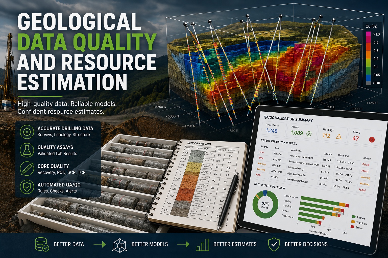
Whether evaluating a mineral deposit, planning a mine, designing a major infrastructure project, or assessing groundwater resources, every geological interpretation begins with data. Drillholes, samples, laboratory analyses, geological logging, geotechnical measurements, and geophysical surveys collectively form the foundation upon which three-dimensional geological models and resource estimates are built.
The accuracy of these models depends directly on the quality of the underlying data. Poor data quality leads to unreliable interpretations, increased project risk, inaccurate resource estimates, higher development costs, and potentially costly engineering decisions.
As exploration programs become larger and regulatory requirements become more stringent, organizations are increasingly adopting automated Quality Assurance and Quality Control (QA/QC) systems to validate geological information before it reaches the modeling stage.
This article explores the relationship between geological data quality and resource estimation, the most common data quality issues encountered in exploration projects, and how automated validation helps improve confidence in geological models and resource calculations.
Why Data Quality Matters
Resource estimation is far more than a mathematical exercise. It is an interpretation of geological reality based on thousands—or sometimes millions—of individual observations.
These observations include:
- Drillhole locations
- Survey data
- Lithological logging
- Structural measurements
- Core recovery
- Rock Quality Designation (RQD)
- Assay results
- Density measurements
- Alteration logging
- Geotechnical observations
- Groundwater data
- Laboratory analyses
Every one of these datasets contributes to the geological model. Errors in any one of them can propagate through the entire estimation process.
The principle is simple:
A resource model can never be more accurate than the data used to create it.
The Cost of Poor Geological Data
Data quality problems can have significant consequences throughout the life of a project.
Examples include:
- Incorrect ore boundaries
- Misclassified waste rock
- Inaccurate tonnage calculations
- Poor grade interpolation
- Incorrect density assumptions
- Fault misinterpretation
- Unexpected ground conditions
- Increased drilling costs
- Regulatory review delays
- Reduced investor confidence
Even small transcription errors can alter geological interpretations over large areas.
Geological Data Is Collected from Multiple Sources
Modern exploration projects integrate numerous datasets.
Typical information includes:
Collar Surveys
Accurate collar coordinates and elevations establish the spatial framework for the project.
Errors here affect every subsequent interpretation.
Downhole Surveys
Incorrect azimuth or inclination measurements distort drillhole trajectories.
This can shift geological contacts by tens of metres within a three-dimensional model.
Geological Logging
Lithology, weathering, alteration, mineralization, and structures describe the geology encountered in each interval.
Consistency between geologists is essential.
Core Logging
Measurements such as:
- Recovery
- SCR
- TCR
- RQD
- Fracture frequency
help characterize rock quality.
Laboratory Assays
Chemical analyses provide grade information for:
- Gold
- Copper
- Nickel
- Lithium
- Rare earth elements
- Industrial minerals
Laboratory QA/QC procedures are critical for ensuring analytical accuracy.
Density Measurements
Bulk density directly affects tonnage calculations.
Incorrect density values can significantly alter reported resources.
Common Geological Data Quality Problems
Large drilling programs inevitably contain errors.
Common issues include:
Missing Data
Examples include:
- Missing lithology
- Missing sample intervals
- Missing recovery
- Missing density
- Missing survey information
Incomplete records reduce confidence in geological models.
Overlapping Intervals
Two intervals covering the same depth create ambiguity.
Example:
10.0–12.0 m
11.5–13.0 m
Automated validation immediately detects these conflicts.
Gaps Between Intervals
Unlogged sections may indicate:
- Data entry mistakes
- Missing samples
- Incomplete logging
Every drilled interval should be accounted for.
Invalid Assay Values
Validation can identify:
- Negative concentrations
- Impossible percentages
- Incorrect units
- Duplicate assays
These problems often originate during data import.
Incorrect Coordinates
Examples include:
- Easting swapped with Northing
- Wrong projection
- Incorrect elevation
- Decimal point errors
Spatial errors can dramatically affect geological modeling.
Geological Consistency Checks
Modern QA/QC extends beyond simple range checking.
Relationships between datasets can also be validated.
Examples include:
- Rock intervals should contain RQD.
- Soil intervals should not contain RQD.
- Recovery cannot exceed 100%.
- SCR cannot exceed TCR.
- RQD cannot exceed SCR.
- Density should exist for resource calculations.
- Sample intervals should align with geological intervals.
- Assays should correspond to valid sample IDs.
These engineering and geological relationships provide powerful automated validation.
Resource Estimation Depends on Consistent Data
Modern resource estimation software relies on structured datasets.
Before estimation begins, geologists typically create:
- Geological wireframes
- Structural models
- Alteration domains
- Mineralized domains
- Grade shells
- Block models
Each interpretation assumes the source data are internally consistent.
If geological logging contains inconsistencies, domain boundaries become unreliable.
Confidence Categories Depend on Data Quality
Most international reporting codes—including NI 43-101, JORC, and SAMREC—require resource classifications that reflect confidence in the available information.
Higher-quality datasets support higher-confidence classifications because they demonstrate consistent, complete, and well-documented information.
Although confidence classifications depend on many geological and statistical factors, robust QA/QC practices strengthen the evidence supporting those classifications and improve the overall defensibility of the resource model.
QA/QC During Exploration
Data quality should be monitored throughout the exploration program rather than after drilling has finished.
Typical workflow:
- Drill completed.
- Core logged.
- Samples collected.
- Laboratory results imported.
- Automatic validation executed.
- Errors corrected.
- Data approved.
- Geological model updated.
Continuous QA/QC prevents large backlogs of corrections.
Automated Validation Rules
Modern geological databases can automatically evaluate hundreds of validation rules.
Examples include:
| Validation Rule | Purpose |
|---|---|
| Collar coordinates present | Verify spatial completeness |
| Survey depths increase correctly | Detect trajectory errors |
| Lithology covers entire borehole | Ensure complete logging |
| No overlapping intervals | Maintain interval integrity |
| No depth gaps | Confirm complete records |
| Recovery ≤ 100% | Prevent impossible values |
| SCR ≤ TCR | Validate recovery calculations |
| RQD ≤ SCR | Ensure logical consistency |
| Sample IDs unique | Prevent duplicate assays |
| Assays within expected ranges | Identify outliers |
| Density recorded for ore intervals | Support tonnage estimation |
| Required fields complete | Improve database quality |
Automated validation allows every borehole to be checked consistently using the same engineering and geological standards.
Supporting Geological Modeling
Clean data dramatically improves geological interpretation.
Benefits include:
- Better lithological contacts
- Improved structural models
- More reliable grade interpolation
- Reduced manual editing
- Faster model updates
- Higher confidence in geological domains
Because fewer errors reach the modeling stage, geologists spend more time interpreting geology and less time correcting database problems.
Improving Auditability
Major exploration projects frequently undergo independent technical reviews.
Auditors often examine:
- Sample traceability
- Data completeness
- QA/QC procedures
- Validation records
- Laboratory controls
- Geological consistency
An automated validation system provides a documented audit trail showing when data were checked, what issues were identified, how they were resolved, and who approved the changes. This level of transparency strengthens confidence in the database and supports regulatory and due diligence reviews.
Data Migration and Legacy Projects
Many organizations are digitizing decades of historical exploration data from spreadsheets, paper logs, and legacy geological databases.
Common migration issues include:
- Incorrect field mapping
- Unit conversion errors
- Missing coordinates
- Duplicate records
- Lost lithology codes
- Incomplete assays
- Inconsistent terminology
Running automated validation immediately after import helps identify these issues before historical data are incorporated into new geological models.
The Role of Standardized Data
Standardized coding systems improve both data quality and interoperability.
Examples include:
- Standard lithology codes
- Controlled alteration vocabularies
- Consistent stratigraphic names
- Uniform weathering classifications
- Standard laboratory units
- Validated sample numbering
Standardization reduces ambiguity and enables easier integration with modeling software, GIS platforms, reporting tools, and industry exchange formats such as AGS and DIGGS.
How WinLoG Supports Geological Data Quality
WinLoG includes an advanced validation framework designed specifically for geological, geotechnical, hydrogeological, and environmental drilling projects. Instead of checking only whether fields are populated, WinLoG evaluates engineering and geological relationships across multiple datasets.
The validation engine can automatically detect missing intervals, overlapping depths, inconsistent lithology, invalid Recovery, SCR, TCR, and RQD relationships, duplicate sample identifiers, incomplete laboratory data, missing density values, groundwater inconsistencies, and many other common data quality issues.
Validation can be performed during data entry, after importing AGS, DIGGS, CSV, or legacy databases, or across an entire project prior to reporting or resource modeling. Detailed validation reports categorize issues by severity, provide explanations for each finding, and maintain an audit trail that supports technical reviews and regulatory compliance.
Organizations can also customize rule libraries to reflect company standards, exploration protocols, or jurisdiction-specific reporting requirements, ensuring that every project is evaluated consistently.
Best Practices for Maintaining High-Quality Geological Data
Organizations that consistently produce reliable geological models typically follow several best practices:
- Standardize logging procedures across all projects.
- Use controlled vocabularies and coding systems.
- Validate data during entry rather than after reporting.
- Perform project-wide QA/QC before resource estimation.
- Review and resolve validation warnings promptly.
- Maintain complete audit trails of edits and approvals.
- Regularly verify imported and historical datasets.
- Train logging geologists and database administrators on QA/QC procedures.
- Establish company-specific validation rules based on exploration experience.
These practices reduce errors, improve consistency, and increase confidence in geological interpretations.
Conclusion
Reliable resource estimation begins with reliable geological data. Every collar survey, lithological description, assay result, density measurement, and core logging observation contributes to the geological model that ultimately guides engineering decisions, mine planning, infrastructure design, and investment.
Poor-quality data introduce uncertainty that can affect resource estimates, increase project risk, and reduce confidence in technical reports. Automated validation addresses these challenges by continuously checking for missing information, impossible values, inconsistent relationships, overlapping intervals, and other common data issues before they reach the modeling stage.
As exploration datasets continue to grow in size and complexity, automated QA/QC is becoming an essential component of modern geological data management. By combining standardized workflows with intelligent validation tools, organizations can build more accurate geological models, produce more defensible resource estimates, and make better-informed decisions throughout the life of a project.