
Introduction
Understanding subsurface geology is essential for many industries, including geotechnical engineering, hydrogeology, environmental consulting, mining exploration, and infrastructure development. Engineers and geologists rely on geological models to visualize soil layers, rock formations, groundwater systems, and structural features beneath the ground surface.
Historically, geological interpretations were created manually using hand-drawn cross-sections and geological maps. While these methods were effective, they required significant time and expertise, and updating interpretations after new data was collected could be difficult.
Today, geological modeling software has transformed how subsurface data is analyzed and visualized. Modern digital tools allow geologists to import borehole databases, generate cross-sections, build three-dimensional geological models, and simulate subsurface processes.
These software platforms play a critical role in interpreting borehole data and communicating geological information to engineers, planners, and project stakeholders.
This article explores the different types of geological modeling software used in subsurface investigations, the capabilities of these tools, and the role they play in modern geotechnical and geological workflows.
The Purpose of Geological Modeling Software
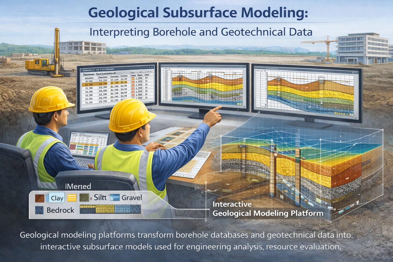
Geological modeling software is designed to convert raw geological data into visual representations of the subsurface. These representations help geologists and engineers understand the structure and distribution of geological materials beneath a site.
Subsurface data can come from many sources, including:
- borehole logs
- geological maps
- geophysical surveys
- laboratory test results
- groundwater monitoring data
Geological modeling software integrates these datasets into a unified system that allows users to visualize and interpret subsurface conditions.
The primary goal of these tools is to improve the accuracy and efficiency of geological interpretation.
By transforming complex datasets into visual models, geological software helps professionals identify patterns and relationships that may not be obvious from individual borehole logs.
Types of Geological Modeling Software
Geological modeling software can be divided into several categories based on their primary functions.
Cross-Section Visualization Software
Some geological programs focus primarily on generating geological cross-sections from borehole data.
These tools allow users to import borehole logs, align them along section lines, and correlate geological layers between boreholes.
Cross-section software is commonly used in geotechnical engineering and environmental investigations because it provides a straightforward way to visualize subsurface stratigraphy.
These programs are often designed to work directly with borehole databases and may include tools for editing layer correlations and adjusting interpretations.
Fence Diagram and Stratigraphic Modeling Software
Fence diagram software extends cross-section visualization by combining multiple intersecting cross-sections into three-dimensional frameworks.
Fence diagrams allow geologists to visualize how geological layers extend in multiple directions across a site.
These tools are particularly useful for identifying complex geological structures such as buried channels, sediment lenses, and pinch-outs.
By examining cross-sections from different perspectives, geologists can develop more accurate interpretations of subsurface stratigraphy.
Three-Dimensional Geological Modeling Software
Three-dimensional modeling software allows geologists to build full 3D representations of subsurface geology.
These models integrate data from boreholes, geological maps, and geophysical surveys to create continuous surfaces representing geological layers.
3D models provide a more complete view of subsurface conditions than individual cross-sections or fence diagrams.
These models are widely used in mining exploration, groundwater modeling, and infrastructure planning.
Three-dimensional models can also be used to estimate volumes of geological units, evaluate resource deposits, and simulate groundwater flow.
Geotechnical Analysis Software
Some software platforms combine geological modeling capabilities with geotechnical analysis tools.
These programs may include modules for evaluating soil strength, slope stability, settlement, and groundwater flow.
By integrating geological models with engineering analysis tools, these platforms allow engineers to evaluate how subsurface conditions influence structural performance.
Data Inputs for Geological Modeling
Geological modeling software relies on accurate input data to produce reliable results.
The most common data source used in geological modeling is borehole data. Borehole logs provide direct observations of subsurface materials and form the foundation of most geological models.
Typical borehole data includes:
- borehole coordinates
- ground surface elevation
- lithology intervals
- soil classifications
- groundwater observations
Geological maps may also provide valuable information about surface geology and regional stratigraphy.
Geophysical surveys can supplement borehole data by providing information about subsurface structures between boreholes.
Combining multiple data sources allows geologists to build more comprehensive geological models.
The Role of Borehole Databases
Structured borehole databases are essential for modern geological modeling workflows.
Instead of storing borehole logs as individual documents, databases organize geological information into standardized tables.
These tables typically include:
- borehole collar data
- lithology intervals
- laboratory test results
- groundwater measurements
By storing data in structured databases, geological software can automatically import and visualize borehole information.
This approach improves efficiency and reduces the risk of data errors.
Interpolation and Geological Interpretation
One of the most important functions of geological modeling software is interpolation.
Interpolation refers to the process of estimating geological conditions between known data points.
Because boreholes only sample specific locations, geological models must estimate how layers extend between them.
Interpolation algorithms use mathematical techniques to generate continuous surfaces representing geological layers.
However, automated interpolation must always be guided by geological interpretation.
Geologists must review the model to ensure that the results are consistent with known geological processes and depositional environments.
Advantages of Digital Geological Modeling
Digital geological modeling offers several advantages over traditional manual interpretation methods.
One of the most significant advantages is improved visualization. Three-dimensional models allow geologists to examine subsurface structures from multiple perspectives.
This capability makes it easier to identify geological patterns that may not be visible in two-dimensional cross-sections.
Another advantage is efficiency. Once borehole data has been imported into modeling software, users can quickly generate cross-sections, maps, and volumetric calculations.
Digital models are also easier to update when new data becomes available. If additional boreholes are drilled during a project, the model can be updated without completely redrawing the interpretation.
Applications of Geological Modeling Software
Geological modeling software is used in many fields.
Geotechnical Engineering
Engineers use geological models to understand soil stratigraphy beneath construction sites. These models support foundation design, slope stability analysis, and infrastructure planning.
Hydrogeology
Hydrogeologists use geological models to analyze groundwater flow systems. Understanding the distribution of permeable and impermeable layers is essential for predicting groundwater movement.
Environmental Investigations
Environmental scientists use geological models to track contaminant migration through soil and groundwater systems.
Mining Exploration
Mining companies use geological models to evaluate ore deposits and estimate mineral resources.
Challenges in Geological Modeling
Although geological modeling software provides powerful visualization tools, it also presents several challenges.
One challenge is data quality. Geological models are only as reliable as the data used to create them. Inaccurate borehole logs or inconsistent lithology descriptions can produce misleading results.
Another challenge is interpretation bias. Automated modeling tools may generate smooth surfaces that appear realistic but may not reflect the true complexity of geological processes.
Geologists must therefore carefully review model outputs and adjust interpretations as needed.
Best Practices for Using Geological Modeling Software
To produce reliable geological models, engineers and geologists should follow several best practices.
First, ensure that borehole data is carefully validated before importing it into modeling software.
Second, standardize lithology descriptions to ensure that similar materials are grouped consistently.
Third, review interpolation results to ensure that they are consistent with geological knowledge and field observations.
Finally, update models regularly as new borehole data becomes available.
Future Trends in Geological Modeling
Advances in computing power and data integration are driving new developments in geological modeling.
Cloud-based modeling platforms allow project teams to collaborate on geological models from different locations.
Machine learning algorithms may also play a role in analyzing large geological datasets and identifying patterns in subsurface data.
As these technologies continue to evolve, geological modeling tools will become even more powerful and accessible.
Conclusion
Geological modeling software has become an essential tool for interpreting subsurface conditions in engineering, environmental science, and resource exploration.
By integrating borehole data, geological maps, and geophysical surveys, these tools allow geologists and engineers to build detailed models of subsurface geology.
Although digital modeling tools have greatly improved efficiency and visualization, accurate geological interpretation still depends on high-quality data and expert analysis.
When used correctly, geological modeling software provides valuable insights into subsurface structure and supports better decision-making in complex engineering and geological projects.
Learn more about our Solutions
- GaeaSynergy Platform for Geoscientific Analysis
- WinLoG Borehole and Well Log Data Management
- WinFence Cross-section and Fence Diagram Visualization
Related Articles
- Geological Cross-Sections from Borehole Data: A Complete Engineering Guide
- Common Mistakes When Creating Geological Cross-Sections from Borehole Data
- How Borehole Spacing Affects Geological Cross-Section Accuracy
- Preparing Borehole Databases for Cross-Section Software
- How Lithological Correlation Works Between Boreholes
- Understanding Fence Diagrams in Geological Modeling
- Common Data Errors in Borehole Databases and How to Fix Them
- Using Geological Cross-Sections in Geotechnical Engineering
- Borehole Coordinate Systems and Mapping for Geological Modeling
- Depth vs Elevation in Borehole Databases for Geological Modeling
- Interpreting Geological Variability Between Boreholes
- Building Geological Cross-Sections from Borehole Data: A Step-by-Step Workflow
- How Geological Software Interpolates Subsurface Layers Between Boreholes
- Borehole Data Visualization Techniques for Geological Modeling
- Managing Large Borehole Data Sets in Engineering Projects
- Understanding Pinch-Outs and Missing Geological Layers in Subsurface Interpretation