
Borehole investigations are fundamental to geotechnical engineering, hydrogeology, environmental monitoring, and mineral exploration. During drilling programs, professionals collect extensive subsurface information including soil descriptions, rock formations, groundwater levels, sampling intervals, and laboratory analytical results. This information, collectively known as borehole data, provides the foundation for engineering analysis and environmental decision‑making.
Modern projects often generate thousands of data records across multiple drilling locations, laboratories, and monitoring events. Without proper management practices, borehole datasets can become disorganized, inconsistent, or difficult to analyze. Effective borehole data management ensures that subsurface information remains accurate, accessible, and useful for future investigations.
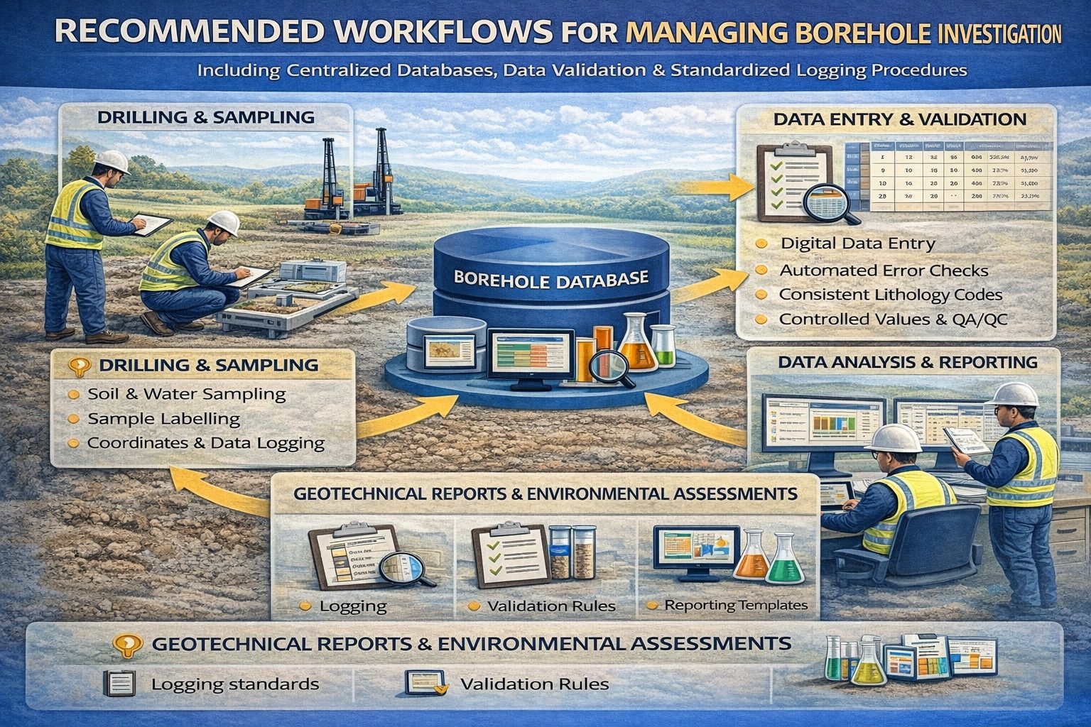
This article explores best practices for managing borehole data, including standardized logging procedures, quality control systems, database management strategies, and digital workflows used by modern engineering and environmental organizations.
Understanding Borehole Data
Borehole data refers to the geological, geotechnical, and environmental information collected during drilling investigations. Each borehole provides a vertical profile of subsurface conditions at a specific location.
Typical borehole datasets include:
- Drilling logs and lithology descriptions
- Soil and rock classifications
- Sampling depths and intervals
- Groundwater measurements
- Geotechnical field test results
- Laboratory analytical results
- Monitoring well construction details
These datasets help engineers and scientists understand underground conditions and design safe infrastructure, evaluate environmental contamination, or manage groundwater resources.
Why Borehole Data Management Matters
Borehole data is often collected over long time periods and across multiple projects. Poorly managed datasets can lead to errors, duplication, and lost information. Effective borehole data management ensures that drilling data remains organized and reliable.
Key benefits of good borehole data management include:
- Improved data accuracy
- Faster data retrieval and analysis
- Better collaboration across teams
- Efficient regulatory reporting
- Long‑term preservation of subsurface knowledge
Organizations that implement structured data management practices can significantly improve the efficiency and reliability of their engineering investigations.
Standardizing Borehole Logging Procedures
One of the most important best practices for borehole data management is standardizing how drilling observations are recorded. Standardized logging procedures ensure that geological descriptions and measurements are consistent across different projects and field teams.
Standardization may include:
- Using consistent lithology terminology
- Adopting standardized soil classification systems
- Recording depths in consistent units
- Using predefined codes for field tests
These practices help maintain consistency across datasets and make it easier to interpret borehole logs during engineering analysis.
Using Standardized Soil Classification Systems
Geotechnical investigations commonly use standardized classification systems to describe soils and rocks. The Unified Soil Classification System (USCS) is one of the most widely used frameworks.
Examples of USCS classifications include:
- CL – Lean clay
- CH – Fat clay
- SM – Silty sand
- SP – Poorly graded sand
- GP – Poorly graded gravel
Using standardized classification codes helps ensure that soil descriptions are consistent across projects and easily interpreted by engineers.
Implementing Data Quality Control
Data quality control procedures help ensure that borehole datasets are accurate and complete. Quality control checks should be performed during both field data collection and database management.
Common quality control procedures include:
- Verifying borehole coordinates and elevations
- Checking sample depths and intervals
- Validating laboratory data against sample identifiers
- Identifying duplicate records
Automated validation tools built into modern borehole databases can perform many of these checks automatically.
Centralized Borehole Databases
One of the most effective ways to manage drilling data is through centralized borehole databases. These systems store all borehole information in structured digital formats.
Centralized databases allow organizations to:
- Store drilling logs and sampling records
- Import laboratory analytical results
- Track groundwater monitoring data
- Generate reports and visualizations
By storing borehole datasets in a central system, organizations can ensure that data remains accessible and consistent across projects.
Integrating Laboratory Data
Laboratory analytical results are an important component of borehole datasets, especially for environmental investigations. Many laboratories deliver results in digital formats such as electronic data deliverables (EDDs).
Automated laboratory data import tools allow these results to be integrated directly into borehole databases. This reduces manual data entry and minimizes the risk of transcription errors.
Digital Borehole Logging
Traditional field logging methods often rely on handwritten notes that must later be digitized. Digital logging systems allow geologists to record drilling observations directly into structured databases using tablets or laptops.
Digital logging provides several advantages:
- Reduced transcription errors
- Faster data availability
- Standardized data entry formats
- Real‑time access to project data
Digital logging tools are becoming increasingly common in modern geotechnical and environmental investigations.
Integration with GIS Systems
Borehole data is inherently spatial because each borehole represents a specific geographic location. Integrating borehole databases with Geographic Information Systems (GIS) allows subsurface data to be visualized on maps.
GIS integration enables:
- Borehole location mapping
- Groundwater contour mapping
- Contamination plume visualization
- Geological cross‑section generation
These spatial analyses help engineers and scientists better understand subsurface conditions across a site.
Maintaining Metadata and Documentation
Metadata describes how and when data was collected. Maintaining clear metadata is essential for interpreting borehole datasets in the future.
Examples of important metadata include:
- Drilling contractor information
- Sampling methods
- Laboratory analytical methods
- Measurement units
Proper documentation ensures that future users understand how datasets were generated.
Ensuring Long‑Term Data Preservation
Borehole data collected during investigations often remains valuable for decades. Historical drilling records can help engineers evaluate site conditions for new projects.
Best practices for long‑term data preservation include:
- Using centralized databases
- Maintaining data backups
- Adopting open data formats
- Documenting metadata
Organizations that preserve historical borehole datasets can significantly reduce investigation costs for future projects.
Benefits of Effective Borehole Data Management
Implementing best practices for borehole data management provides many advantages.
- Improved engineering decision‑making
- More efficient environmental monitoring
- Better regulatory compliance
- Improved collaboration between teams
- Reduced project risks
By maintaining accurate and well‑organized borehole datasets, organizations can unlock the full value of their subsurface information.
Conclusion
Borehole data management is a critical component of geotechnical and environmental investigations. Drilling programs generate complex datasets that must be organized, standardized, and validated to ensure reliability.
Best practices such as standardized logging procedures, centralized borehole databases, laboratory data integration, and GIS visualization tools help organizations manage drilling datasets effectively. These practices improve data accuracy, enhance collaboration, and support better engineering and environmental decision‑making.
As digital technologies continue to advance, modern borehole data management systems will play an increasingly important role in managing subsurface information and supporting responsible infrastructure development.
For a broader overview see the guide: The Complete Guide to Borehole Data Solutions.
Learn more about our Solutions
Related Articles
Explore additional articles in the Borehole Data Solutions series.
- What is Borehole Data? A Complete Introduction
- Types of Borehole Data Collected During Drilling
- Borehole Logging Explained: Methods, Tools, and Data
- Digital Borehole Logging vs Traditional Field Logs
- Borehole Database Systems: How They Work
- How Borehole Data Supports Geotechnical Engineering
- How Borehole Data Supports Environmental Site Assessments
- The Role of Borehole Data in Groundwater Monitoring
- Integrating Borehole Data with GIS Systems
- Borehole Data Standardization and Data Quality
- Borehole Data Visualization and Subsurface Modeling
- Centralizing Borehole Data Across Multiple Projects
- Automating Borehole Log Generation
- Cloud-Based Borehole Data Solutions
- Borehole Data Integration with Laboratory Data
- Borehole Data Management for Large Infrastructure Projects
- Choosing Borehole Data Management Software
- WinLoG Borehole Logging Software for Managing Drilling Data
- Subsurface Data Management for Engineering Projects
- How Engineering Firms Build Centralized Geological Databases
- The Future of Digital Subsurface Investigation Data