
Engineering projects depend heavily on reliable geological information. Before constructing buildings, bridges, tunnels, dams, highways, or energy infrastructure, engineers must understand the conditions beneath the ground surface. Geological formations, soil properties, groundwater conditions, and rock structures all influence how infrastructure should be designed and built.
Subsurface investigations generate large volumes of data through drilling programs, field testing, laboratory analysis, and environmental monitoring. Managing this information efficiently is essential for ensuring that engineering decisions are based on accurate and well‑organized datasets. Engineering geological database systems provide the tools needed to store, manage, analyze, and visualize this information.
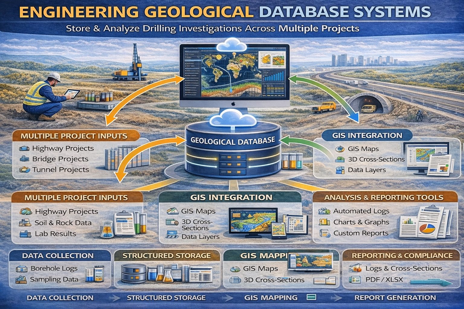
An engineering geological database system is a specialized data management platform designed to organize subsurface geological and geotechnical information. These systems allow engineers, geologists, and environmental scientists to manage borehole logs, laboratory analytical results, groundwater monitoring records, and geological models in centralized digital environments.
This article explores how engineering geological database systems work, the types of data they manage, and the benefits they provide for modern engineering and environmental projects.
Understanding Engineering Geological Data
Engineering geological data refers to information collected about soil, rock, groundwater, and geological conditions that influence engineering design and construction. This data is typically gathered during site investigations carried out before major infrastructure or development projects begin.
Typical engineering geological datasets include:
- Borehole drilling logs
- Lithology descriptions
- Soil and rock classifications
- Geotechnical field test results
- Groundwater measurements
- Laboratory test results
- Environmental monitoring data
Each dataset contributes to a broader understanding of subsurface conditions. When multiple boreholes are drilled across a site, engineers can combine these records to interpret geological structures and groundwater systems.
The Role of Geological Databases in Engineering Projects
Engineering geological database systems are designed to manage large volumes of subsurface data produced during site investigations. These systems provide centralized repositories where drilling records, test results, and monitoring datasets can be stored and accessed.
By organizing geological data in structured databases, engineers can analyze complex datasets more efficiently and reduce the risk of data loss or inconsistencies.
Geological database systems are used in many types of engineering projects, including:
- Transportation infrastructure projects
- Urban development and building construction
- Mining and mineral exploration
- Energy infrastructure projects
- Environmental remediation programs
Borehole Data Management
Borehole data forms the foundation of most engineering geological databases. Boreholes drilled during site investigations provide direct observations of subsurface conditions.
Borehole logs typically record:
- Depth of geological layers
- Soil and rock descriptions
- Sample intervals
- Groundwater observations
- Field test results
Engineering geological database systems store these records in structured formats that allow users to retrieve and analyze drilling data quickly.
Geotechnical Test Data
Geotechnical investigations often include field tests that measure the physical properties of soil and rock. These tests provide important information about the strength and stability of subsurface materials.
Common geotechnical field tests include:
- Standard Penetration Test (SPT)
- Cone Penetration Test (CPT)
- Vane shear tests
- Pressuremeter tests
Engineering geological database systems store these results alongside borehole logs so that engineers can analyze soil behavior and design foundations accordingly.
Laboratory Data Integration
Laboratory testing provides detailed measurements of soil and rock properties that cannot be obtained in the field. Samples collected from boreholes are analyzed in laboratories to determine engineering characteristics.
Common laboratory tests include:
- Grain size distribution analysis
- Atterberg limits testing
- Moisture content determination
- Shear strength testing
- Consolidation testing
Engineering geological database systems integrate laboratory results with borehole sample records. This integration ensures that laboratory data remains linked to the correct sampling locations and depths.
Groundwater Monitoring Data
Groundwater conditions can significantly influence engineering design. High groundwater levels can affect excavation stability, foundation performance, and long‑term structural behavior.
Monitoring wells installed in boreholes allow engineers to measure groundwater levels and water quality over time. Engineering geological database systems store these monitoring records and allow engineers to track changes in groundwater conditions.
Typical groundwater datasets include:
- Water level measurements
- Groundwater sampling results
- Hydraulic conductivity measurements
- Water chemistry analysis
Centralized Data Storage
One of the most important benefits of engineering geological database systems is centralized data storage. Instead of storing drilling data in separate spreadsheets or project reports, organizations can maintain a unified database containing all geological records.
Centralized systems provide several advantages:
- Improved data organization
- Consistent data formats
- Easier access to historical records
- Reduced risk of data duplication
This approach allows engineering teams to reuse valuable geological datasets across multiple projects.
GIS Integration
Engineering geological data is inherently spatial because each borehole or monitoring well corresponds to a specific location. Many geological database systems integrate with Geographic Information Systems (GIS) to support spatial analysis.
GIS integration allows users to:
- Map borehole locations
- Visualize geological layers across project areas
- Create groundwater contour maps
- Identify environmental contamination zones
Spatial visualization tools help engineers interpret complex subsurface datasets more effectively.
Visualization and Geological Modeling
Modern geological database systems include visualization tools that transform raw datasets into graphical representations of subsurface conditions.
These tools may generate:
- Borehole logs
- Geological cross sections
- 3D subsurface models
- Groundwater monitoring charts
Visualization tools allow engineers to identify geological patterns and communicate findings more clearly in engineering reports.
Supporting Collaboration Across Engineering Teams
Engineering projects often involve collaboration between geologists, geotechnical engineers, environmental scientists, and construction teams. Geological database systems provide shared platforms where these teams can access the same datasets.
Collaborative data environments improve communication and ensure that engineering decisions are based on consistent information.
Long‑Term Value of Geological Databases
Subsurface investigation data often remains valuable long after a project is completed. Historical drilling records can provide useful insights for future construction projects or infrastructure upgrades.
Engineering geological database systems allow organizations to preserve these datasets and reuse them in future studies. This can reduce investigation costs and improve project planning.
Future Trends in Geological Data Management
Advances in digital technology are transforming how geological data is managed. Cloud‑based databases, automated data validation tools, and advanced 3D geological modeling platforms are becoming increasingly common.
These technologies allow engineering organizations to manage larger datasets and gain deeper insights into subsurface environments.
Conclusion
Engineering geological database systems play a critical role in managing the complex datasets generated during subsurface investigations. By organizing borehole logs, laboratory results, geotechnical test data, and groundwater monitoring records in centralized databases, these systems allow engineers to analyze subsurface conditions more efficiently.
As engineering projects continue to grow in scale and complexity, effective geological data management will remain essential for supporting safe and reliable infrastructure design. Modern engineering geological database systems provide the tools needed to transform raw subsurface data into valuable insights that guide engineering decisions.
or a broader overview see the guide: The Complete Guide to Borehole Data Solutions.
Learn more about our Solutions
Related Articles
Explore additional articles in the Borehole Data Solutions series.
- What is Borehole Data? A Complete Introduction
- Types of Borehole Data Collected During Drilling
- Borehole Logging Explained: Methods, Tools, and Data
- Digital Borehole Logging vs Traditional Field Logs
- Borehole Database Systems: How They Work
- How Borehole Data Supports Geotechnical Engineering
- How Borehole Data Supports Environmental Site Assessments
- The Role of Borehole Data in Groundwater Monitoring
- Integrating Borehole Data with GIS Systems
- Borehole Data Standardization and Data Quality
- Borehole Data Visualization and Subsurface Modeling
- Best Practices for Borehole Data Management
- Centralizing Borehole Data Across Multiple Projects
- Automating Borehole Log Generation
- Cloud-Based Borehole Data Solutions
- Borehole Data Integration with Laboratory Data
- Borehole Data Management for Large Infrastructure Projects
- Choosing Borehole Data Management Software
- WinLoG Borehole Logging Software for Managing Drilling Data
- Subsurface Data Management for Engineering Projects
- The Future of Digital Subsurface Investigation Data