
Drilling investigations are one of the most important methods used to understand subsurface conditions. Engineers, geologists, hydrogeologists, and environmental scientists rely on drilling programs to collect detailed information about the ground beneath a site. The information gathered during these investigations is known as borehole data.
Drilling investigations produce many types of subsurface data including lithology descriptions, soil classifications, groundwater levels, drilling methods, and laboratory analytical results. Together, these datasets provide a detailed picture of underground conditions that cannot be observed directly from the surface.
Why Borehole Data Collection is Important
Understanding subsurface conditions is essential before constructing buildings, roads, pipelines, or other infrastructure. Surface observations alone cannot provide enough information about underground materials.
- Soil and rock composition
- Depth of geological layers
- Groundwater conditions
- Engineering properties of soils
- Environmental contamination levels
This information helps engineers reduce uncertainty and design safe structures.
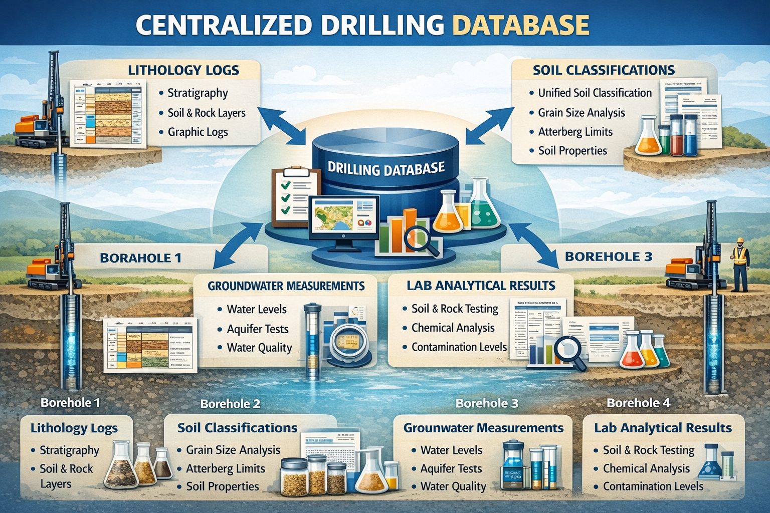
Lithology Descriptions
Lithology describes the physical characteristics of soil and rock layers encountered during drilling. Geologists record information such as soil type, grain size, color, texture, mineral composition, and moisture conditions.
These observations are recorded in borehole logs and help identify geological formations and subsurface stratigraphy.
Soil Classification Data
Soil classification categorizes soils according to their physical and engineering properties. The most widely used system is the Unified Soil Classification System (USCS).
Common soil classifications include clay, silt, sand, gravel, and organic soils. These classifications help engineers determine how soils will behave under load.
Drilling Method Data
Drilling investigations record the methods used to advance boreholes such as hollow-stem auger drilling, rotary drilling, sonic drilling, air rotary drilling, and diamond core drilling.
Recording drilling methods helps ensure that borehole logs accurately represent site conditions and that sampling procedures meet technical standards.
Sample Depth and Sampling Interval Data
Sampling data includes the depth intervals where soil or rock samples were collected. Borehole logs record sample IDs, depth ranges, sampling methods, and recovery percentages.
Common sampling techniques include split spoon sampling, Shelby tube sampling, and core sampling.
Geotechnical Field Test Data
Field tests measure soil properties directly during drilling. The Standard Penetration Test (SPT) is one of the most common tests and provides information about soil density and strength.
Other field tests include cone penetration testing and vane shear tests.
Groundwater Level Measurements
Groundwater levels are measured when drilling intersects the water table. These measurements help hydrogeologists understand groundwater flow and aquifer behavior.
Some boreholes are converted into monitoring wells for long-term groundwater monitoring programs.
Laboratory Analytical Data
Samples collected during drilling are often analyzed in laboratories. Geotechnical tests evaluate properties such as grain size distribution and shear strength, while environmental laboratory tests analyze contaminants such as hydrocarbons, heavy metals, and volatile organic compounds.
Borehole Construction Data
If boreholes are converted into monitoring wells, additional data is recorded including casing diameter, screen interval depths, filter pack materials, and sealing methods.
Borehole Location Data
Each borehole location is recorded using geographic coordinates and elevation data. This spatial information allows boreholes to be mapped and analyzed using geographic information systems.
Borehole Logs
All borehole data is typically summarized in borehole logs which combine lithology descriptions, sampling intervals, groundwater observations, and field test results into a single document.
Conclusion
The types of borehole data collected during drilling include lithology descriptions, soil classifications, drilling methods, sampling intervals, groundwater measurements, geotechnical test results, and laboratory analytical data.
These datasets provide essential information for geotechnical engineering, environmental investigations, groundwater studies, and mineral exploration.
For a broader overview see the guide: The Complete Guide to Borehole Data Solutions.
Learn more about our Solutions
Related Articles
Explore additional articles in the Borehole Data Solutions series.
- What is Borehole Data? A Complete Introduction
- Borehole Logging Explained: Methods, Tools, and Data
- Digital Borehole Logging vs Traditional Field Logs
- Borehole Database Systems: How They Work
- How Borehole Data Supports Geotechnical Engineering
- How Borehole Data Supports Environmental Site Assessments
- The Role of Borehole Data in Groundwater Monitoring
- Integrating Borehole Data with GIS Systems
- Borehole Data Standardization and Data Quality
- Borehole Data Visualization and Subsurface Modeling
- Best Practices for Borehole Data Management
- Centralizing Borehole Data Across Multiple Projects
- Automating Borehole Log Generation
- Cloud-Based Borehole Data Solutions
- Borehole Data Integration with Laboratory Data
- Borehole Data Management for Large Infrastructure Projects
- Choosing Borehole Data Management Software
- WinLoG Borehole Logging Software for Managing Drilling Data
- Subsurface Data Management for Engineering Projects
- How Engineering Firms Build Centralized Geological Databases
- The Future of Digital Subsurface Investigation Data