
Understanding subsurface conditions is essential for engineering, environmental investigations, groundwater studies, and mineral exploration. Because the underground environment cannot be directly observed from the surface, drilling investigations are conducted to collect samples and gather information about soil and rock formations beneath the ground.
One of the most important processes during drilling investigations is borehole logging. Borehole logging is the process of documenting geological observations during drilling. Field geologists record soil layers, rock formations, drilling conditions, and sampling intervals as the borehole advances.
What is Borehole Logging?
Borehole logging is the systematic process of recording geological and drilling information as a borehole is drilled into the ground.
- Soil and rock types
- Depth intervals of geological layers
- Groundwater conditions
- Sample locations
- Drilling methods and conditions
- Field test results
These observations are compiled into a borehole log, which provides a vertical record of subsurface conditions encountered during drilling.
Why Borehole Logging is Important
Borehole logging provides essential information that supports engineering design, environmental assessments, and geological research.
- Understanding subsurface conditions
- Supporting foundation and infrastructure design
- Identifying groundwater conditions
- Detecting environmental contamination
- Developing geological models
The Borehole Logging Process
Drilling the Borehole
Drilling rigs advance boreholes using methods such as hollow-stem auger drilling, rotary drilling, sonic drilling, and diamond core drilling.
Sample Collection
Samples are collected at regular depth intervals using techniques such as split spoon sampling, Shelby tube sampling, and core sampling.
Geological Observation
Field geologists examine the recovered materials and document characteristics such as grain size, color, texture, and rock weathering.
Recording Depth Intervals
Each geological layer encountered is recorded with precise depth measurements to create an accurate stratigraphic profile.
Groundwater Observations
When groundwater is encountered, the depth to the water table and any seepage zones are documented.
Field Testing
Tests such as the Standard Penetration Test (SPT) are conducted during drilling to measure soil density and strength.
Information Recorded in Borehole Logs
- Borehole identification and location
- Drilling methods and equipment
- Lithology descriptions
- Sample intervals and recovery
- Field test results
- Groundwater levels
Borehole Log Formats
Borehole logs are typically displayed as vertical diagrams that illustrate subsurface layers along a depth scale. These diagrams often include graphical symbols representing soil and rock types, sample intervals, and field test results.
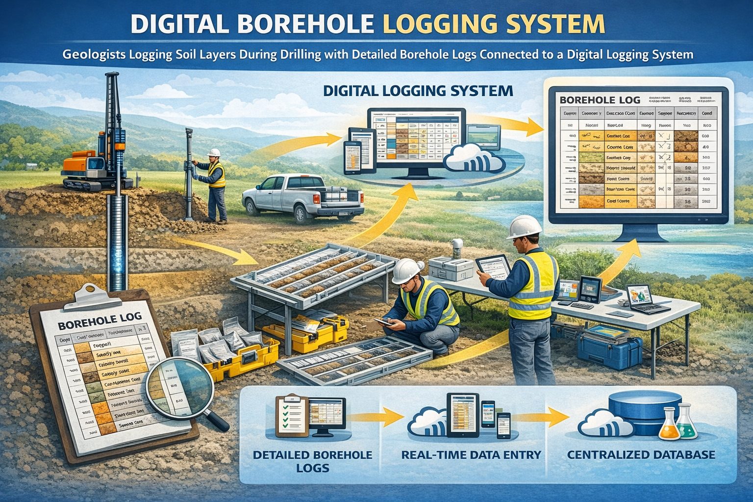
Digital Borehole Logging
Many organizations now use digital borehole logging software and mobile devices to record observations directly in the field. Digital logging improves efficiency, reduces transcription errors, and allows borehole data to be stored in centralized databases.
Applications of Borehole Logging
Geotechnical Engineering
Borehole logs help engineers design foundations, tunnels, retaining walls, and other infrastructure.
Environmental Investigations
Borehole logging helps identify contaminated soil layers and guide environmental sampling programs.
Mining Exploration
Exploration drilling programs rely on borehole logs to identify mineral-bearing formations.
Hydrogeology
Hydrogeologists use borehole logs to understand aquifers and groundwater flow systems.
Conclusion
Borehole logging is a critical part of drilling investigations that documents subsurface conditions including soil layers, rock formations, groundwater observations, and sampling intervals. Accurate borehole logs provide the information needed for engineering design, environmental monitoring, and geological analysis.
For a broader overview see the guide: The Complete Guide to Borehole Data Solutions.
Learn more about our Solutions
Related Articles
Explore additional articles in the Borehole Data Solutions series.
- What is Borehole Data? A Complete Introduction
- Types of Borehole Data Collected During Drilling
- Digital Borehole Logging vs Traditional Field Logs
- Borehole Database Systems: How They Work
- How Borehole Data Supports Geotechnical Engineering
- How Borehole Data Supports Environmental Site Assessments
- The Role of Borehole Data in Groundwater Monitoring
- Integrating Borehole Data with GIS Systems
- Borehole Data Standardization and Data Quality
- Borehole Data Visualization and Subsurface Modeling
- Best Practices for Borehole Data Management
- Centralizing Borehole Data Across Multiple Projects
- Automating Borehole Log Generation
- Cloud-Based Borehole Data Solutions
- Borehole Data Integration with Laboratory Data
- Borehole Data Management for Large Infrastructure Projects
- Choosing Borehole Data Management Software
- WinLoG Borehole Logging Software for Managing Drilling Data
- Subsurface Data Management for Engineering Projects
- How Engineering Firms Build Centralized Geological Databases
- The Future of Digital Subsurface Investigation Data