
Environmental Site Assessments (ESAs) are conducted to evaluate the environmental condition of a property and identify potential contamination in soil, groundwater, or sediments. These investigations are commonly required for property transactions, regulatory compliance, redevelopment projects, and environmental remediation programs. One of the most important sources of information during an environmental investigation is borehole data.
Borehole data collected during environmental drilling programs provides critical information about subsurface conditions, contamination levels, groundwater movement, and the presence of pollutants. Environmental professionals rely on this data to assess environmental risk, understand contaminant migration, and design remediation strategies.
Modern environmental investigations generate large amounts of data from drilling logs, groundwater samples, laboratory analytical results, and monitoring well networks. Because of this complexity, many organizations use environmental borehole data management systems to store and organize investigation data. These systems track monitoring wells, groundwater samples, laboratory results, and environmental monitoring records in centralized databases that support long‑term environmental management.
Understanding Environmental Site Assessments
An Environmental Site Assessment is a process used to evaluate whether a property may be contaminated due to historical or current activities.
Phase I Environmental Site Assessment
A Phase I ESA involves reviewing historical records, site inspections, and regulatory databases to identify potential environmental concerns.
Phase II Environmental Site Assessment
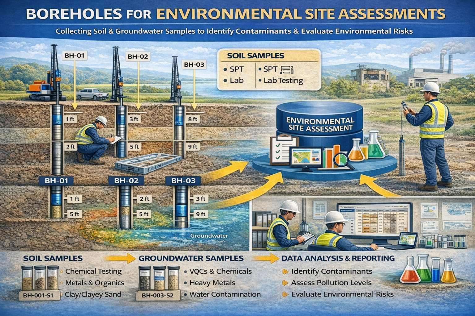
If potential contamination is identified during Phase I, a Phase II ESA is conducted. This phase includes drilling boreholes, collecting soil samples, and installing groundwater monitoring wells.
Environmental Borehole Data
Environmental borehole data refers to geological, chemical, and hydrological information collected during drilling investigations performed as part of environmental assessments.
- Drilling logs and lithology descriptions
- Soil sampling intervals
- Groundwater measurements
- Monitoring well construction details
- Laboratory analytical results
- Environmental monitoring records
Soil Sampling and Contamination Analysis
Soil samples collected from boreholes are analyzed in laboratories to detect contaminants such as petroleum hydrocarbons, heavy metals, solvents, and other pollutants.
Groundwater Monitoring Wells
Monitoring wells are often installed within boreholes to track groundwater conditions and contamination over time.
- Well casing diameter
- Screen interval depth
- Filter pack materials
- Seal and grout layers
Groundwater Sampling
Groundwater samples collected from monitoring wells are analyzed for contaminants such as hydrocarbons, solvents, metals, and industrial chemicals.
Environmental Monitoring Records
Environmental monitoring programs track contamination trends over time using groundwater sampling events and monitoring data.
Environmental Borehole Data Management Systems
Environmental borehole data management systems provide centralized databases for storing drilling logs, laboratory results, and groundwater monitoring records.
- Centralized borehole databases
- Monitoring well tracking
- Laboratory data import
- Groundwater monitoring management
- Environmental reporting tools
- GIS integration
GIS Integration
Geographic Information Systems (GIS) are often used to map borehole locations, visualize contaminant plumes, and analyze groundwater flow patterns.
Benefits of Environmental Borehole Databases
- Improved data organization
- Faster environmental reporting
- Better regulatory compliance
- Improved collaboration across teams
Conclusion
Borehole data is essential for environmental site assessments because it provides detailed information about subsurface contamination and groundwater conditions. Environmental borehole data management systems allow organizations to track monitoring wells, groundwater samples, laboratory results, and environmental monitoring records efficiently.
By organizing environmental drilling data in centralized databases, environmental professionals can better understand contamination conditions and support long‑term site management.
For a broader overview see the guide: The Complete Guide to Borehole Data Solutions.
Learn more about our Solutions
Related Articles
Explore additional articles in the Borehole Data Solutions series.
- What is Borehole Data? A Complete Introduction
- Types of Borehole Data Collected During Drilling
- Borehole Logging Explained: Methods, Tools, and Data
- Digital Borehole Logging vs Traditional Field Logs
- Borehole Database Systems: How They Work
- How Borehole Data Supports Geotechnical Engineering
- The Role of Borehole Data in Groundwater Monitoring
- Integrating Borehole Data with GIS Systems
- Borehole Data Standardization and Data Quality
- Borehole Data Visualization and Subsurface Modeling
- Best Practices for Borehole Data Management
- Centralizing Borehole Data Across Multiple Projects
- Automating Borehole Log Generation
- Cloud-Based Borehole Data Solutions
- Borehole Data Integration with Laboratory Data
- Borehole Data Management for Large Infrastructure Projects
- Choosing Borehole Data Management Software
- WinLoG Borehole Logging Software for Managing Drilling Data
- Subsurface Data Management for Engineering Projects
- How Engineering Firms Build Centralized Geological Databases
- The Future of Digital Subsurface Investigation Data