
The Phase I Environmental Site Assessment (ESA) has traditionally relied on records review, site reconnaissance, and interviews to identify potential environmental contamination risks. While these core components remain unchanged under ASTM E1527-21, technology is rapidly enhancing how Environmental Professionals (EPs) collect and document site information.
One of the most impactful advancements in recent years is the use of unmanned aerial vehicles (UAVs), commonly known as drones.
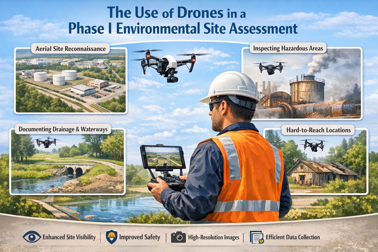
Drones are transforming Phase I ESAs by providing:
- Enhanced site visibility
- Improved documentation quality
- Access to difficult or unsafe areas
- High-resolution imagery for analysis and reporting
Although drones do not replace traditional methods, they are becoming an increasingly valuable tool for augmenting site reconnaissance and strengthening environmental due diligence.
This article explores the role of drones in Phase I ESAs, including their applications, benefits, limitations, regulatory considerations, and best practices.
What Are Drones in the Context of Environmental Site Assessments?
Drones are remotely operated or autonomous aerial systems equipped with sensors such as:
- High-resolution cameras
- Thermal imaging sensors
- Multispectral sensors
- LiDAR (in advanced applications)
In a Phase I ESA, drones are primarily used for visual inspection and documentation, supporting the non-intrusive nature of the assessment.
Why Drones Are Gaining Popularity in Phase I ESAs
Traditional site reconnaissance is conducted on foot, which can limit:
- Visibility of large or complex sites
- Access to restricted or hazardous areas
- Ability to capture comprehensive site imagery
Drones address these limitations by providing:
- Aerial perspectives
- Rapid data collection over large areas
- Consistent and repeatable documentation
As a result, they are increasingly being adopted as a standard enhancement to site inspections.
Applications of Drones in Phase I ESA
1. Aerial Site Reconnaissance
Drones provide a bird’s-eye view of the property, allowing EPs to:
- Understand site layout and boundaries
- Identify drainage patterns and surface water flow
- Observe relationships between features
This is particularly useful for:
- Large industrial sites
- Agricultural properties
- Remote or undeveloped land
Aerial imagery can reveal patterns that are not visible from ground level.
2. Identification of Potential Environmental Concerns
Drones can help detect visual indicators of contamination, including:
- Stained soil or pavement
- Disturbed or discolored areas
- Stressed vegetation
- Improper waste disposal
From above, these features often appear more clearly, especially when they cover large areas.
3. Inspection of Inaccessible or Hazardous Areas
One of the most valuable uses of drones is accessing areas that are:
- Unsafe (e.g., unstable structures, contaminated zones)
- Physically inaccessible (e.g., rooftops, fenced areas, wetlands)
- Restricted due to operational constraints
Examples include:
- Roof inspections for HVAC systems or venting
- Tank tops and elevated structures
- Dense vegetation or steep terrain
This improves both safety and completeness of the assessment.
4. Documentation of Drainage and Surface Water
Drones are highly effective for analyzing:
- Drainage pathways
- Stormwater infrastructure
- Surface water bodies
Aerial imagery can show:
- Flow direction
- Connections between drainage features
- Potential contaminant migration pathways
This aligns directly with the need to document environmental pathways in a Phase I ESA.
5. Photographic Documentation and Reporting
High-resolution drone imagery enhances reporting by:
- Providing clear, detailed visuals
- Supporting findings and conclusions
- Improving communication with clients
Drone images can be used to:
- Annotate site features
- Highlight areas of concern
- Create maps and visual summaries
This significantly improves the quality and professionalism of the final report.
6. Orthomosaic Mapping and Site Models
Advanced drone applications include:
- Orthomosaic maps (georeferenced aerial images)
- 3D site models
These tools allow EPs to:
- Measure distances and areas
- Analyze site features in detail
- Create accurate visual representations
While not always required, they can add significant value for complex sites.
Benefits of Using Drones in Phase I ESA
Improved Efficiency
Drones can survey large areas quickly, reducing:
- Time spent on site
- Fieldwork costs
This is especially beneficial for:
- Large industrial properties
- Multi-acre developments
Enhanced Data Quality
Drone imagery provides:
- High-resolution visuals
- Consistent documentation
- Comprehensive site coverage
This leads to more accurate observations and stronger conclusions.
Increased Safety
By reducing the need for physical access, drones help avoid:
- Hazardous environments
- Structural risks
- Exposure to contaminants
Safety is a major advantage, particularly for industrial sites.
Better Client Communication
Aerial imagery is easy to understand and visually compelling.
It helps:
- Clients visualize site conditions
- Stakeholders understand risks
- Decision-makers interpret findings quickly
Improved Defensibility
Drone imagery strengthens the report by:
- Providing clear evidence
- Supporting observations
- Enhancing documentation
This improves the defensibility of the Phase I ESA.
Limitations of Drone Use in Phase I ESA
Despite their advantages, drones have limitations.
Regulatory Restrictions
Drone use is subject to aviation regulations, such as:
- Transport Canada rules (in Canada)
- FAA regulations (in the United States)
Requirements may include:
- Pilot certification
- Airspace restrictions
- Flight permissions
Weather Dependence
Drone operations can be affected by:
- Wind
- Rain
- Snow
- Low visibility
Poor weather may limit or delay flights.
Privacy and Security Concerns
Flying drones near:
- Residential areas
- Sensitive facilities
may raise privacy or security issues.
Proper planning and communication are essential.
Data Interpretation Still Required
Drones collect data—but interpretation still depends on:
- Professional judgment
- Environmental expertise
They are a tool, not a replacement for expertise.
Not a Substitute for Ground Inspection
Drones cannot:
- Detect odors
- Assess subtle ground-level conditions
- Replace interviews or records review
They must be used in conjunction with traditional methods.
Regulatory Considerations
In Canada, drone operations are governed by Transport Canada.
Environmental professionals must ensure:
- Proper certification (Basic or Advanced Operations)
- Compliance with airspace restrictions
- Safe operation near people and structures
Failure to comply can result in fines or legal issues.
Best Practices for Using Drones in Phase I ESA
To maximize value, drones should be used strategically.
Plan the Flight
- Identify key areas of interest
- Consider site layout and obstacles
- Check weather and airspace conditions
Focus on Relevant Features
Capture imagery of:
- Storage tanks and equipment
- Drainage features
- Surface water bodies
- Areas of potential contamination
Integrate with Ground Observations
Combine drone data with:
- On-site inspection
- Interviews
- Records review
This ensures a comprehensive assessment.
Document and Annotate
- Label images clearly
- Include location references
- Highlight areas of concern
Maintain Data Quality
- Use high-resolution settings
- Ensure proper lighting and angles
- Avoid blurry or unclear images
The Future of Drones in Environmental Assessments
Drone technology continues to evolve, with emerging capabilities such as:
- AI-based image analysis
- Real-time data processing
- Advanced sensors for environmental monitoring
In the future, drones may play an even greater role in:
- Identifying contamination patterns
- Supporting risk assessments
- Enhancing environmental reporting
Conclusion
Drones are revolutionizing how Phase I Environmental Site Assessments are conducted. By enhancing site reconnaissance, improving documentation, and increasing safety, they provide significant value to Environmental Professionals and their clients.
While they do not replace traditional methods, drones serve as a powerful complementary tool—helping to identify environmental risks more effectively and present findings more clearly.
As technology continues to advance, the integration of drones into Phase I ESAs will likely become not just an advantage, but an industry standard.
👉 Learn more about our Automated Environmental Site Assessment Solution
Related Articles
- Overview of a Phase I Environmental Site Assessment (ESA): A Complete Guide for Due Diligence
- Key Uses of a Phase I Environmental Site Assessment
- Market for Phase I Environmental Site Assessments
- The Role of Historical Source Review in Phase I Environmental Site Assessments
- The Role of Environmental Database Reviews in Phase I Environmental Site Assessments
- The Review of Property Records in a Phase I Environmental Site Assessment
- The Role of Visual Inspections in a Phase I Environmental Site Assessment
- Identifying Hazardous Substances and Petroleum Products in a Phase I Environmental Site Assessment
- Documenting Drainage Patterns and Surface Water in a Phase I Environmental Site Assessment
- The Role of Photographs in Phase I Environmental Site Assessments
- Conducting Interviews with Property Owners and Occupants for a Phase I ESA
- Conducting Interviews with Government Officials for a Phase I ESA
- Conducting Interviews with Neighbors for a Phase I ESA
- Key Components of a Phase I ESA Conclusion
- Key Distinctions Between ASTM E1527-21 and CSA Z768-01