
The geotechnical and environmental software landscape is evolving rapidly, driven by advances in artificial intelligence, cloud computing, data integration, and sustainability demands. As infrastructure projects grow more complex and regulatory expectations tighten, software platforms are shifting from passive data repositories to intelligent, predictive, and fully integrated ecosystems.
This comprehensive FAQ explores the most important future trends shaping geotechnical and environmental software—and what they mean for engineers, consultants, and organizations planning their digital strategy.
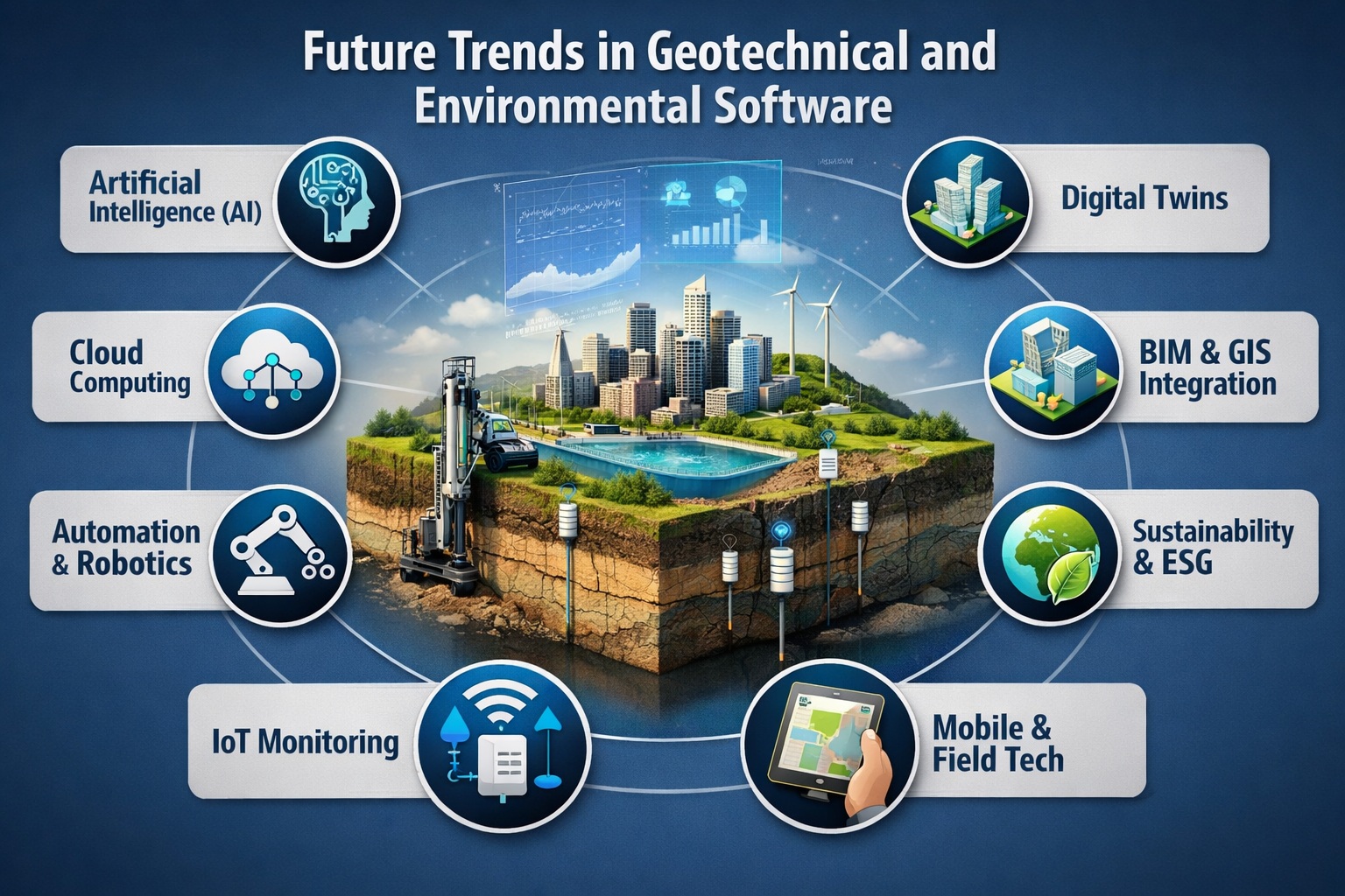
What are the biggest trends shaping geotechnical and environmental software?
Several transformative trends are converging:
- Artificial Intelligence (AI) and Machine Learning (ML)
- Cloud-based collaboration platforms
- Digital twins and real-time data integration
- Automation of workflows and reporting
- Sustainability and ESG-driven analytics
- Integration with BIM and GIS systems
- Mobile and field-first data collection
- Open data standards and interoperability
Among these, AI, cloud computing, and digital twins are the most disruptive forces, fundamentally changing how data is collected, analyzed, and used for decision-making.
AI, for example, is already improving efficiency, safety, and predictive capabilities in engineering workflows by analyzing large datasets and identifying patterns faster than traditional methods .
How is Artificial Intelligence transforming geotechnical software?
Artificial Intelligence is arguably the most impactful trend in geotechnical engineering.
Key Applications of AI:
- Predictive soil behavior modeling
- Automated borehole log interpretation
- Risk assessment and failure prediction
- Intelligent site investigation planning
- Automated report generation
AI enables engineers to extract insights from massive datasets, improving reliability and reducing uncertainty in subsurface analysis .
Example Use Case:
Instead of manually interpreting lab results, AI models can:
- Identify anomalies in soil data
- Predict settlement or slope failure
- Recommend design adjustments
AI also supports generative design, allowing engineers to test multiple design scenarios automatically.
What role will generative AI and large language models (LLMs) play?
Generative AI is the next frontier.
Future Capabilities:
- Natural language queries for data analysis
- Automated creation of technical reports
- Smart assistants for modeling and simulations
- AI-driven recommendations for remediation strategies
Emerging tools already allow engineers to interact with software using plain language, bridging the gap between complex simulations and user intent.
This will significantly reduce training time and make advanced tools accessible to non-specialists.
What are digital twins and why are they important?
A digital twin is a real-time digital replica of a physical asset or system.
In geotechnical and environmental contexts:
- Groundwater systems can be monitored dynamically
- Contaminant plumes can be simulated in real time
- Infrastructure performance can be tracked continuously
Digital twins integrate:
- Field data (IoT sensors)
- Historical datasets
- Predictive models
They enable continuous monitoring and proactive decision-making, reducing risk and lifecycle costs .
How will cloud computing change geotechnical workflows?
Cloud technology is becoming the default deployment model.
Benefits:
- Real-time collaboration across teams
- Centralized data management
- Scalable storage for large datasets
- Remote access to projects
Cloud platforms allow distributed teams to work simultaneously on the same dataset, improving efficiency and reducing errors .
Future Direction:
- Fully web-based geotechnical platforms
- SaaS licensing replacing desktop software
- Seamless integration between office and field
6. What is the future of data management in environmental software?
Environmental data is becoming:
- Larger
- More complex
- More regulated
Key Trends:
- Centralized Environmental Data Management Systems (EDMS)
- Automated validation and QA/QC
- Integration of laboratory and field data
- Real-time dashboards and reporting
Future systems will move toward single source of truth databases, eliminating silos and improving compliance.
How will BIM integration impact geotechnical software?
Building Information Modeling (BIM) is expanding beyond structures into subsurface data.
Benefits of BIM Integration:
- Visualization of geotechnical conditions in 3D
- Improved coordination between disciplines
- Clash detection with underground utilities
- Enhanced design accuracy
AI-powered BIM tools are already automating tasks like model validation and clash detection, improving productivity by up to 25% .
What is OpenBIM and why does it matter?
OpenBIM refers to standardized data formats that allow interoperability between software systems.
Why it matters:
- Eliminates vendor lock-in
- Enables seamless data exchange
- Improves collaboration across stakeholders
As projects involve multiple platforms (GIS, BIM, geotechnical software), interoperability becomes critical.
How is automation improving engineering workflows?
Automation is reducing manual, repetitive tasks.
Examples:
- Automated borehole log generation
- Auto-generated cross-sections
- Report automation
- Data imports and validation
This allows engineers to focus on analysis and decision-making instead of data handling.
Automation also reduces human error and improves consistency.
What role does IoT (Internet of Things) play?
IoT devices are transforming field data collection.
Examples:
- Groundwater monitoring sensors
- Settlement monitoring instruments
- Air and water quality sensors
These devices feed real-time data into software systems, enabling:
- Continuous monitoring
- Early warning systems
- Data-driven decision-making
How will mobile and field technologies evolve?
Field data collection is shifting toward mobile-first solutions.
Future Capabilities:
- Offline data capture with cloud sync
- Real-time validation in the field
- Integration with GPS and mapping tools
- Photo and video documentation
This reduces data entry errors and speeds up workflows.
What is the role of GIS in environmental software?
Geographic Information Systems (GIS) are essential for spatial data analysis.
Integration Trends:
- Seamless GIS + geotechnical data workflows
- Spatial visualization of contamination
- Mapping of boreholes and sampling points
Future systems will unify GIS, BIM, and geotechnical data into a single platform.
How is sustainability influencing software development?
Sustainability is becoming a core requirement.
Software is evolving to support:
- Carbon footprint analysis
- Environmental impact assessments
- Sustainable material selection
- Regulatory compliance tracking
BIM-based tools are already being used for carbon accounting and energy optimization .
What is the impact of robotics and automation in the field?
Robotics is emerging in:
- Drilling operations
- Site inspections
- Data collection
Combined with AI, robotics can improve safety and efficiency, especially in hazardous environments.
How will software support regulatory compliance?
Environmental regulations are becoming stricter.
Future Software Features:
- Automated compliance checks
- Audit trails and data traceability
- Standardized reporting formats
- Integration with regulatory databases
This reduces risk and ensures consistent reporting.
What are digital ecosystems and why are they important?
Modern software is moving toward connected ecosystems rather than standalone tools.
Features:
- Integration across multiple platforms
- Shared data environments
- API-driven connectivity
This enables seamless workflows across:
- Field data collection
- Laboratory systems
- Modeling software
- Reporting tools
How will user experience (UX) evolve?
Future software will prioritize usability.
Trends:
- Intuitive interfaces
- Drag-and-drop workflows
- Dashboard-driven insights
- Reduced training requirements
This is critical as software becomes more complex.
What are the challenges facing future software adoption?
Despite rapid innovation, challenges remain:
- Data quality and standardization
- Resistance to change
- Integration complexity
- Cybersecurity concerns
- High implementation costs
Organizations must balance innovation with practical deployment strategies.
What skills will engineers need in the future?
Engineers will need to combine domain expertise with digital skills.
Key Skills:
- Data analysis
- AI and automation understanding
- Software integration knowledge
- Cloud-based workflows
The role of engineers is shifting from data processors to decision-makers.
What does the future look like for geotechnical and environmental software?
The future is intelligent, connected, and predictive.
Key Characteristics:
- AI-driven decision support
- Fully integrated data ecosystems
- Real-time monitoring and digital twins
- Cloud-first platforms
- Automation of routine tasks
Ultimately, software will evolve from a tool into a strategic partner in engineering projects.
Conclusion
Geotechnical and environmental software is undergoing a profound transformation. Technologies like AI, digital twins, cloud computing, and IoT are not just enhancing existing workflows—they are redefining them.
Organizations that embrace these trends will benefit from:
- Increased efficiency
- Better decision-making
- Reduced risk
- Improved sustainability outcomes
Those that do not risk falling behind in an increasingly competitive and data-driven industry.
Learn more about our Software Solutions
- GaeaSynergy Platform for Geoscientific Analysis and Visualization
- WinLoG: Borehole and Well Logs
- WinFence: Cross-sections and Fence Diagrams
- GDMS: Geotechnical Data Management System
- EDMS: Environmental Data Management System
- POLLUTEv8: Contaminant Transport Modeling and Landfill Design
- E-ASR: Automated Environmental Reporting
Related Articles
- How to Evaluate Geotechnical & Environmental Software (Buyer’s Guide)
- GaeaSynergy: Integrated Geological, Geotechnical, and Environmental Data Management Platform
- Integrated vs Standalone Geotechnical Software: Which Is Better?
- Top Features to Look for in Geotechnical & Environmental Software
- Why Centralized Data Management Is Critical for Geotechnical Projects
- How to Streamline Geotechnical Workflows from Field to Report
- How Automation Improves Efficiency in Environmental Data Management
- Cloud vs Desktop Geotechnical Software: Pros and Cons
- How to Automate Environmental Reporting
- How Environmental Software Helps with Regulatory Compliance
- How to Run a Successful Software Pilot Project
- Understanding Total Cost of Ownership for Engineering Software
- How to Calculate ROI for Geotechnical and Environmental Software Investments
- Top 10 Mistakes When Buying Engineering Software (And How to Avoid Them)
- Step-by-Step Guide to Selecting Engineering Software