
Engineering, environmental, and geological projects depend on accurate understanding of subsurface conditions. Borehole drilling programs, laboratory testing, groundwater monitoring, and geological interpretations all generate valuable datasets that describe the ground beneath a site. Over the past several decades, the management of this information has evolved from paper logs and isolated spreadsheets to sophisticated digital databases and modeling tools.
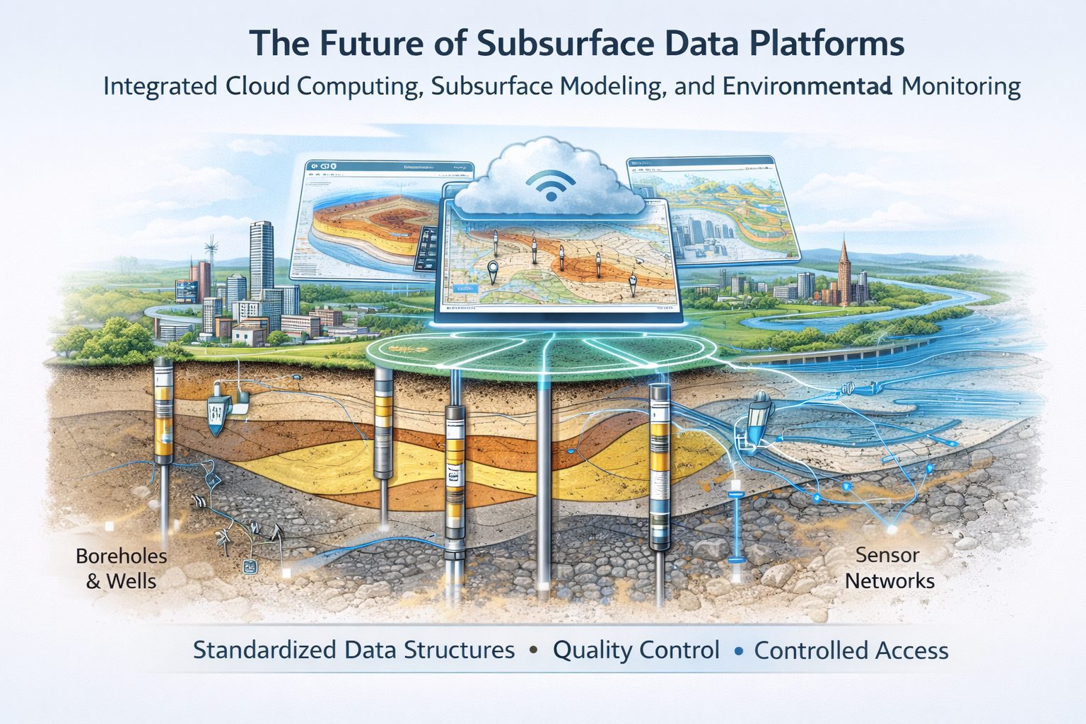
Integrated subsurface data platforms represent the latest stage in this evolution. These platforms combine geological, geotechnical, environmental, and spatial datasets into unified systems that allow professionals to manage, analyze, and visualize subsurface information efficiently.
As digital technologies continue to advance, integrated subsurface data platforms are expected to become even more powerful. New developments in cloud computing, automation, data analytics, and visualization are transforming how subsurface data is collected, managed, and interpreted.
This article explores the future of integrated subsurface data platforms, highlighting emerging technologies and trends that will shape the next generation of geological and engineering data systems.
The Evolution of Subsurface Data Management
Subsurface data management has undergone significant changes over time.
In the past, borehole logs and geological records were often stored in paper reports or physical archives. Engineers and geologists manually interpreted these records to create cross-sections and geological maps.
As digital tools became available, many organizations began storing subsurface data in spreadsheets or simple databases. While this improved accessibility, these systems were often fragmented and lacked integration with modeling and visualization tools.
Modern integrated platforms now connect multiple subsurface datasets, including:
- borehole databases
- geotechnical laboratory results
- geological interpretations
- GIS mapping layers
- environmental monitoring data
- 3D geological models
These integrated systems allow professionals to manage subsurface data throughout the entire lifecycle of a project.
However, the demand for more advanced data analysis and collaboration continues to grow. The next generation of platforms will address these needs through new technological capabilities.
Cloud-Based Subsurface Data Platforms
One of the most significant trends in subsurface data management is the shift toward cloud-based platforms.
Traditional geological databases were often stored on local servers within individual organizations. While effective for internal use, these systems made collaboration across teams and organizations more difficult.
Cloud-based platforms provide several advantages:
- remote access to subsurface data
- real-time collaboration between teams
- centralized data storage
- improved data security and backup systems
Engineers, geologists, and environmental specialists working in different locations can access the same datasets through cloud systems.
Cloud platforms also allow organizations to scale their data storage and computing resources as project demands increase.
Real-Time Data Collection and Integration
Advances in field technology are enabling real-time data collection during subsurface investigations.
Modern drilling rigs, geophysical instruments, and monitoring sensors can generate digital data that is transmitted directly to centralized databases.
Examples of real-time data integration include:
- automated logging of drilling data
- digital recording of cone penetration testing (CPT) measurements
- continuous groundwater monitoring sensors
- remote environmental monitoring systems
By connecting these devices to integrated data platforms, organizations can receive immediate updates as new data becomes available.
Real-time data integration allows engineers and geologists to make faster decisions during investigations and construction activities.
Artificial Intelligence and Machine Learning
Artificial intelligence (AI) and machine learning technologies are beginning to influence geological and geotechnical data analysis.
Large subsurface datasets contain patterns and relationships that may be difficult to detect using traditional methods. Machine learning algorithms can analyze these datasets to identify trends and correlations.
Potential applications of AI in subsurface data platforms include:
- automated lithology classification from drilling data
- prediction of geological formations between boreholes
- identification of anomalies in geotechnical test results
- predictive modeling of groundwater flow or contamination migration
While human expertise will always remain essential for geological interpretation, AI tools may assist professionals by providing additional insights and analytical capabilities.
Advanced 3D and 4D Subsurface Modeling
Three-dimensional geological modeling has become a standard feature of many modern subsurface data platforms.
These models allow users to visualize geological layers, structural features, and groundwater systems in a realistic spatial context.
In the future, modeling capabilities are expected to expand further with the introduction of 4D modeling, which incorporates changes over time.
Examples of time-based modeling include:
- groundwater level fluctuations
- contaminant plume migration
- consolidation of soils during construction
- long-term environmental monitoring data
4D models allow engineers and environmental scientists to understand how subsurface conditions evolve over time.
These dynamic models may become important tools for infrastructure management and environmental monitoring.
Integration with Digital Twin Technology
Digital twin technology is emerging as a powerful tool for infrastructure management.
A digital twin is a digital representation of a physical system that continuously integrates real-world data.
For infrastructure projects, digital twins may include:
- structural models of buildings and bridges
- environmental monitoring systems
- geotechnical and geological models
By integrating subsurface data platforms with digital twin environments, engineers can simulate how geological conditions influence infrastructure performance.
For example, digital twins could monitor groundwater levels around foundations or track ground movement near tunnels.
This integration will help engineers anticipate potential risks and maintain infrastructure more effectively.
Improved Data Visualization and User Interfaces
As subsurface datasets grow in complexity, improved visualization tools are becoming increasingly important.
Future data platforms will likely include advanced visualization features such as:
- interactive 3D geological models
- immersive virtual reality environments
- web-based visualization dashboards
- customizable data analytics tools
These tools will allow users to explore subsurface data more intuitively and communicate findings more effectively.
For example, engineers may use virtual reality to examine geological models or present subsurface conditions to project stakeholders.
Integration Across Disciplines
Modern engineering projects often involve collaboration between multiple disciplines.
Subsurface data platforms are evolving to support integration across fields such as:
- geology
- geotechnical engineering
- environmental science
- hydrogeology
- GIS and spatial analysis
Future platforms will likely provide seamless workflows that allow professionals from different disciplines to work within the same system.
For example, geological interpretations may be linked directly to geotechnical parameters and environmental monitoring datasets.
This interdisciplinary integration improves the accuracy of subsurface analysis and enhances collaboration.
Data Governance and Standardization
As subsurface data platforms become more sophisticated, effective data governance will become increasingly important.
Future platforms will likely incorporate stronger governance frameworks that ensure:
- consistent data standards
- automated validation and quality control
- secure data access controls
- comprehensive audit trails
Standardized data structures will also support interoperability between different software systems and organizations.
This standardization will allow subsurface datasets to be shared more easily across projects and institutions.
Supporting Sustainable Infrastructure Development
Sustainable infrastructure development requires careful consideration of environmental conditions and long-term impacts.
Integrated subsurface data platforms can support sustainability efforts by providing detailed information about geological and environmental conditions.
Examples include:
- groundwater resource management
- assessment of soil stability and erosion risks
- monitoring environmental remediation projects
- evaluating geological hazards
By integrating environmental monitoring data with geological models, future platforms will help organizations make more sustainable decisions about land use and infrastructure development.
The Role of Open Data and Data Sharing
Another emerging trend is the increased availability of open geological data.
Government agencies and research institutions are increasingly publishing geological and environmental datasets for public use.
Integrated subsurface data platforms may incorporate these datasets to enhance local project analysis.
Examples of publicly available data may include:
- regional geological maps
- groundwater monitoring records
- seismic hazard datasets
- environmental monitoring networks
Combining project-specific data with regional datasets can provide a broader understanding of geological conditions.
Challenges and Opportunities
Despite their many advantages, future subsurface data platforms will also face several challenges.
Data Complexity
Managing large volumes of geological and environmental data requires sophisticated database structures and computational resources.
Data Security
As platforms move to cloud environments, ensuring data security and privacy will remain a priority.
Training and Adoption
New technologies often require training and changes to established workflows.
Organizations will need to invest in training programs to ensure that professionals can effectively use advanced data platforms.
Conclusion
Integrated subsurface data platforms are transforming how geological, geotechnical, and environmental information is managed and interpreted. By connecting borehole databases, geological models, GIS mapping, and monitoring systems within unified platforms, these systems provide powerful tools for understanding subsurface conditions.
The future of subsurface data platforms will be shaped by advances in cloud computing, real-time data integration, artificial intelligence, and advanced visualization technologies. These innovations will allow professionals to analyze subsurface conditions more efficiently and make more informed decisions about engineering and environmental projects.
As infrastructure development, environmental protection, and resource management continue to rely on accurate subsurface information, integrated data platforms will play an increasingly important role in supporting sustainable and resilient engineering solutions.
The continued evolution of these platforms will help organizations manage complex datasets, improve collaboration across disciplines, and unlock new insights into the geological systems that shape our built and natural environments.
Learn more about our Solutions
- GaeaSynergy Platform for Geoscientific Analysis
- Borehole and Well Log Data Management
- Cross Sections and Sub-surface Visualization
- Geotechnical Data Management System
- Environmental Data Management System
Related Articles
- GaeaSynergy: Integrated Geological, Geotechnical, and Environmental Data Management Platform
- The Complete Guide to Borehole Data Solutions
- The Complete Guide to Geotechnical Data Management
- The Complete Guide to Environmental Data Management
- Geological Cross-Sections from Borehole Data: A Complete Engineering Guide
- Integrated Geological and Geotechnical Data Platforms
- Why Engineering Firms Need Integrated Subsurface Data Platforms
- Managing Geological, Geotechnical, and Environmental Data in One Platform
- Digital Platforms for Subsurface Investigation Data
- Connecting Borehole Databases with Geological Modeling Software
- GIS Integration in Geological and Geotechnical Data Platforms
- Data Governance in Geological and Engineering Platforms
- How Artificial Intelligence Is Transforming Geotechnical & Environmental Engineering
- Beyond 2D: Integrating Boring Logs with 3D Models for Complex Infrastructure Projects
- Protecting Our Water: Monitoring Contaminant Plumes Through Real-Time Stratigraphic Mapping
- Strategic Data Management in GaeaSynergy
- Seamless Data Flow: Mastering Import and Export in GaeaSynergy
- Mapping the Site: GIS and Spatial Data Management in GaeaSynergy
- Comprehensive Site Intelligence: Integrating Subsurface Data and Infrastructure in GaeaSynergy 3D
- Visualizing the Invisible: 3D Above and Below Ground Structures in GaeaSynergy
- Mastering Subsurface Visualization: Contouring and Gridding in GaeaSynergy
- From Data to Discovery: Visualizing the Subsurface with GaeaSynergy
- GAEA Technologies Software in the Oil & Gas Industry
- Beyond the Surface: How GAEA Technologies Software Powers Modern Mining
- Winning More Bids: Using High-Resolution Subsurface Visualization to Demonstrate Project Certainty
- Selecting the Right Gridding Algorithm for Your Contour Map
- The Science of Doubt: How to Quantify and Visualize Subsurface Uncertainty in Geological Models
- Geoscientific Analysis: Key Uses and Benefits