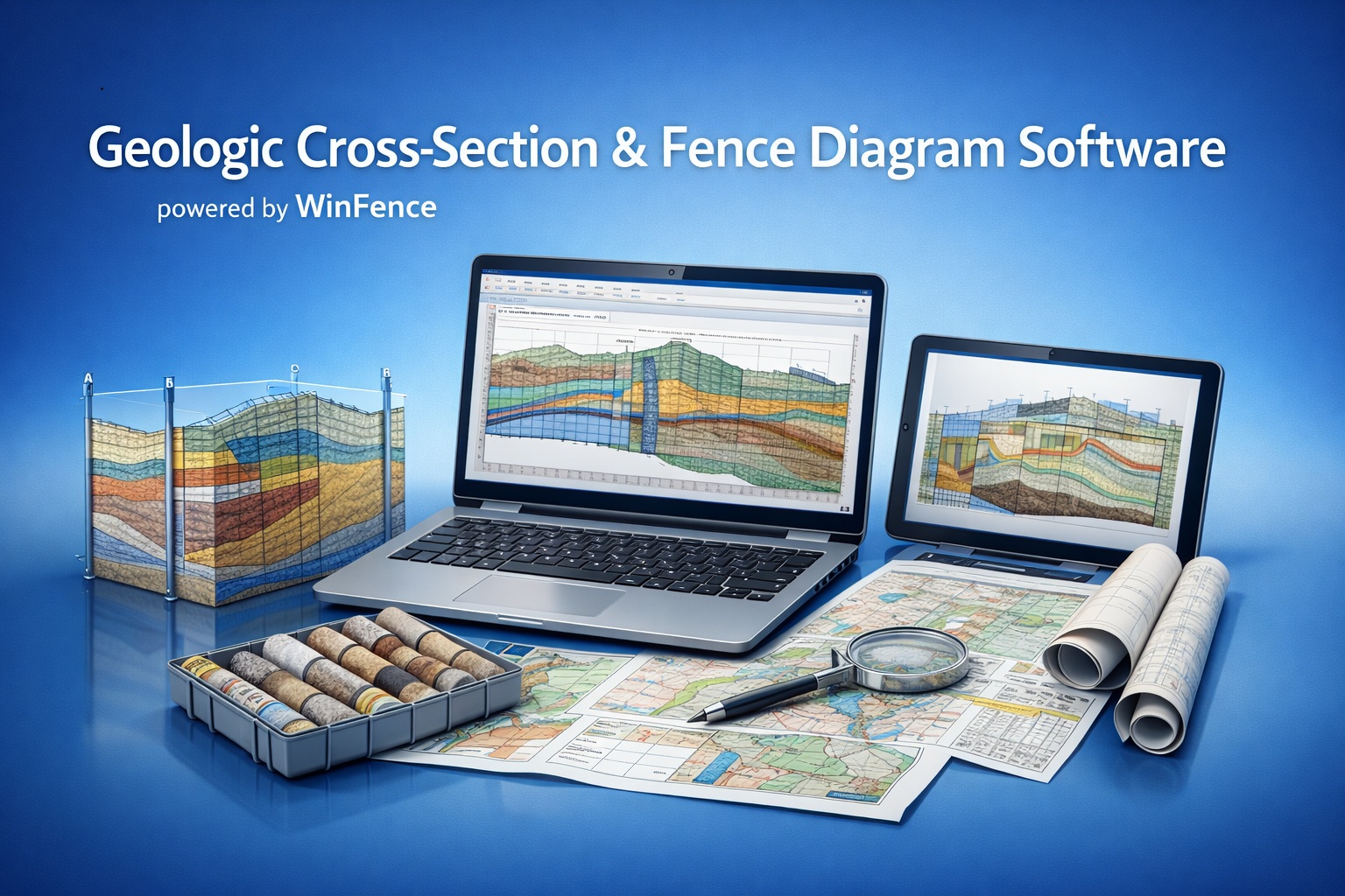
Geologic Cross-Section & Fence Diagram Software for Borehole Data
Create accurate subsurface profiles in minutes — no CAD, no manual drafting, no wasted time.
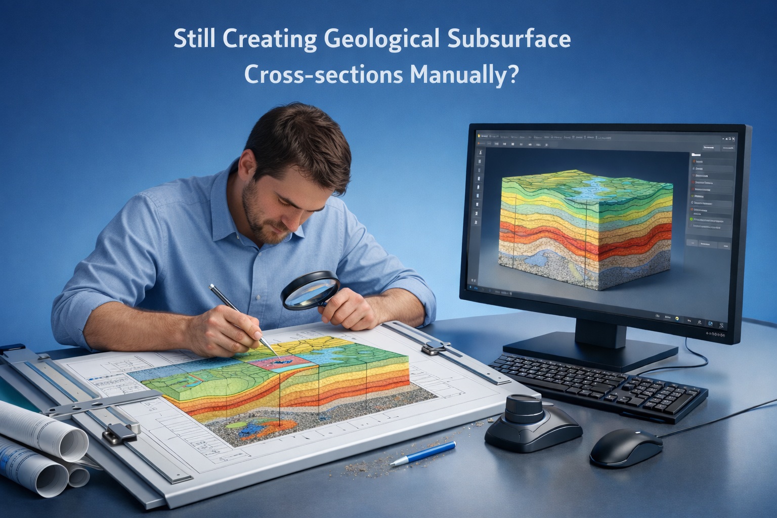
If you’re using CAD or spreadsheets to build geologic cross-sections, you’re likely dealing with:
👉 These inefficiencies cost time, money, and accuracy.
WinFence is purpose-built geological software designed to transform borehole data into clear, accurate cross-sections and fence diagrams.
Transform your geologic workflows with WinFence, the ultimate cross-section and fence diagram software. Say goodbye to the frustration of complicated tools and hello to effortless, intuitive solutions. Easily visualize subsurface geology and empower your projects through increased productivity. If you're ready to cast aside dense software, start your journey with WinFence today!
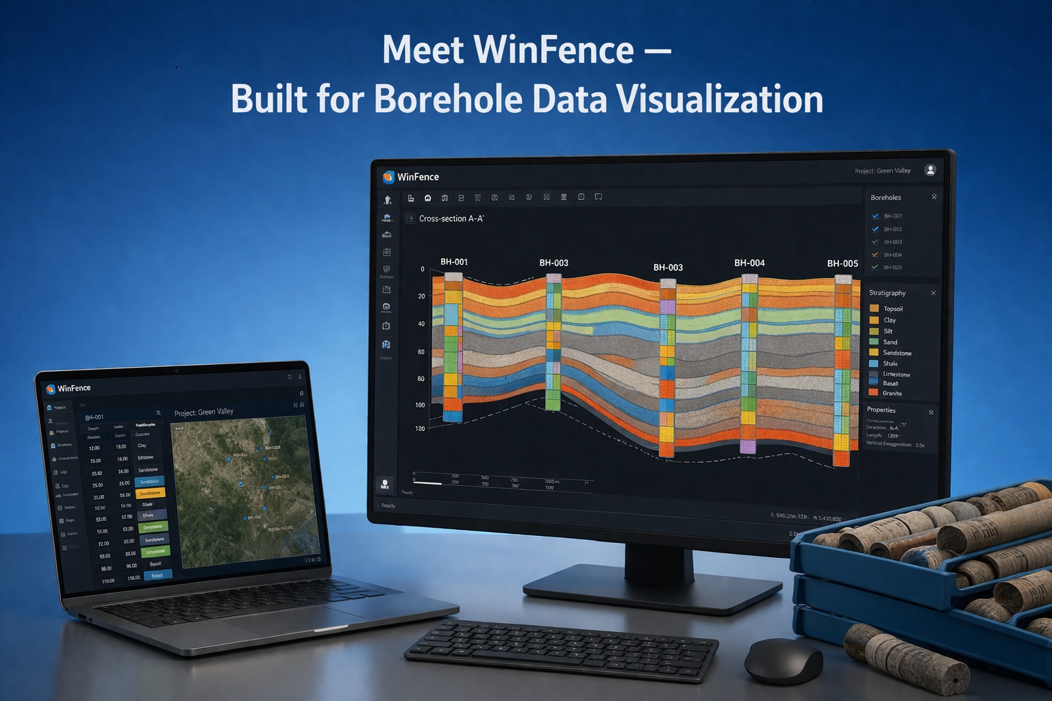
The WinFence module of GaeaSynergy can be used to quickly create detailed full color cross-sections. A wide variety of strata can be used to create cross-sections; such as layers, faults, lenses, intrusions, and alteration zones. This module shares the same database as the WinLoG module and can be used to access and plot the boring and well data.
There is the option to have the program automatically generate the cross-section using the borehole and well data. When determining how to connect the strata between boreholes, wells, and intersecting cross-sections the program looks at the similarities in the lithologies, thicknesses, and occurrence of the strata.
A unique snapping approach can be used to add layer boundaries. This approach allows the boundary of one strata to be fixed to the boundary of another strata. Making the input of strata boundaries quick and accurate.
After the cross-sections have been created, they can be displayed in 3D as fence diagrams.
Choosing the right visualization tool for subsurface data can make or break an engineering project. While the “Software Showdown” often highlights ease of use versus power, the real winner depends on your specific workflow.
Want to learn more about how subsurface visualization can turn your borehole into clear geological insight?
Join thousands who rely on our software for their projects.
Working globally to simplify geotechnical and geoscientific data handling.
Engineered and designed for performance—trusted by professionals like you.
Experience user-friendly software with no commitment.
Complete your purchase in just a few clicks.
Complete your work faster and with less hassle.
GAEA Technologies develops and distributes geoscience and engineering solutions worldwide. Our solutions have been used for over 30 years by companies and organizations around the world.
© 2026 - All Rights Reserved/span>