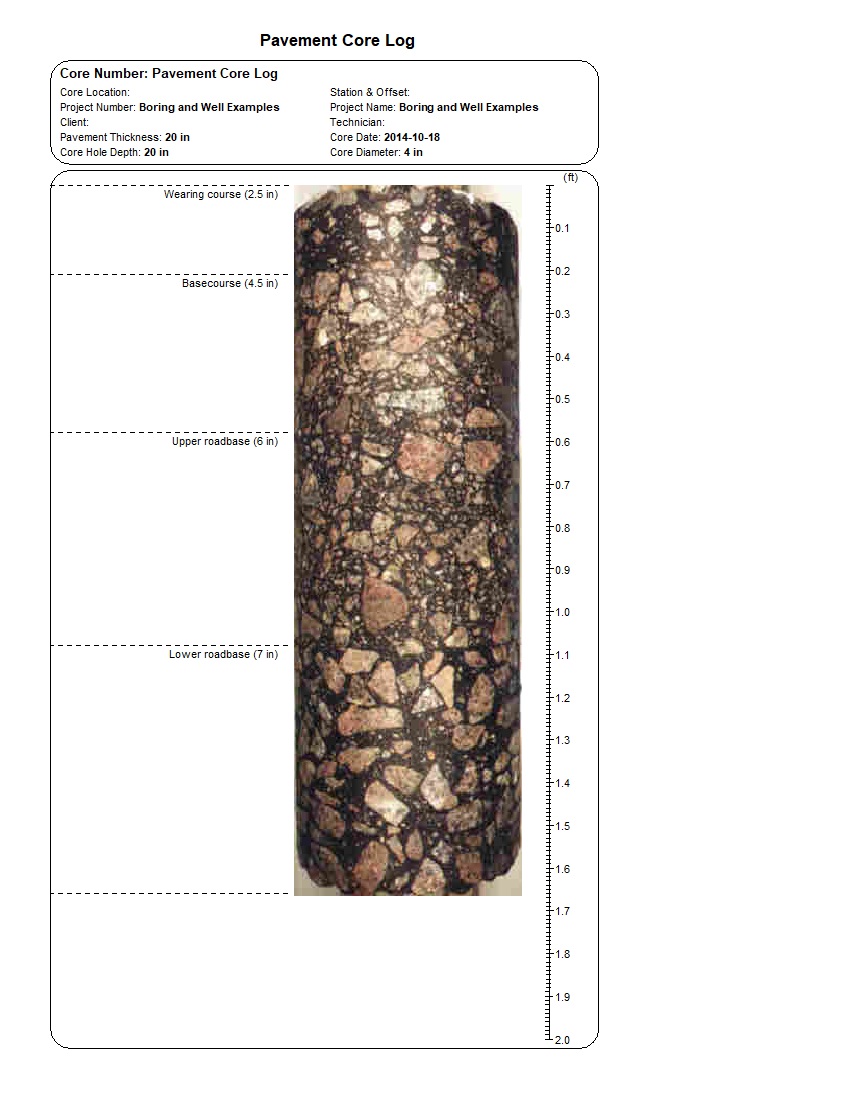
This specialized example shows how WinLoG documents a pavement core with a continuous photograph and depth-referenced layer boundaries. The Pavement Core Log displays the wearing course, basecourse, upper roadbase, and lower roadbase beside a foot-scale image of the recovered core.
The example records a 4 in diameter, 20 in pavement core dated October 18, 2014. Automated validation passes the record with 100% completeness, 85% confidence, and no errors or warnings.
The pavement-core format focuses on visual and dimensional documentation rather than a conventional soil-boring column. A continuous photograph is aligned with four material intervals so the reported layer thicknesses can be reviewed against the physical core.
The supplied validation report records Passed status, 100% completeness, Good quality, an 85% confidence score, and zero errors and zero warnings.
Download the example files individually. The XML template and log can be imported into WinLoG Version 6 and customized for company-specific geotechnical workflows.
Demonstrates a clear format for documenting pavement structure, core thickness, layer contacts, and visual condition.
Provides a consistent core record for roadway rehabilitation, pavement evaluation, asset management, and design investigations.
Shows how recovered-core photography and measured pavement layers can be combined in a concise, reviewable deliverable.
WinLoG templates can be customized to match company standards, project requirements, and agency formats. Core-photo dimensions, layer labels, depth units, pavement material names, header fields, and validation rules can be tailored to project requirements.
Contact GAEA Technologies
GAEA Technologies develops and distributes geoscience and engineering solutions worldwide. Our solutions have been used for over 30 years by companies and organizations around the world.
© 2026 - All Rights Reserved/span>